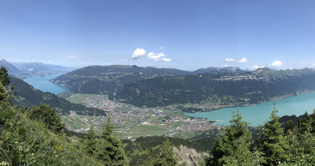
Interlaken sits between two lakes, and most of what people come for lies on one of them or above both — but not all of it, and the trips that get left out are often the better ones. This guide covers 49 destinations, each with the travel time from Interlaken Ost, what it actually costs and how long it takes. Every entry works as a day trip by public transport — no car needed, and none of them is much more than two hours away. Prices and journey times come directly from the operators and the Swiss timetable.
In the region today
Between the lowest and the highest destination on this page lie 2,895 metres of altitude: from 559 m (Spiez Castle) to 3,454 m (Jungfraujoch — Top of Europe). That is why one figure for “the weather in Interlaken” does not cover this page.
Forecast computed for the altitude of both destinations. Data: Open-Meteo.com (CC BY 4.0)
The ten shortest outings, in order
Every list like this one ranks by taste. This one ranks by the clock: how much of a day each destination takes door to door, counting the journey both ways from Interlaken Ost plus the time you spend there. It is the one ordering on this page that comes from measured numbers rather than from us — and it is not a quality ranking. The meadow at number one is a meadow.
Ranked by the share of a day they cost, shortest first
Day budget = twice the checked journey time from Interlaken Ost plus the middle of the stated time on site. Journey times come from the Swiss timetable, prices from the operators; both are the same figures as in the full table below. Two assumptions, and they are the only ones: “half day” is counted as 4 hours and “full day” as 8. One thing the number cannot see: for the two boat trips the journey time is the walk to the pier, not the crossing — the crossing is the outing, and it sits in the “on site” column. Destinations without a checked journey time are left out rather than ranked at zero.
Where is what?
Orientation map: relative positions to scale from coordinates, without terrain. Destinations more than 28 km away sit at the edge of the map in their direction, with the straight-line distance from Interlaken Ost. Without a fixed location and therefore not on the map: Paragliding and Canyoning & rafting.
Travel times: fastest public connection from Interlaken Ost to the destination itself — for mountain destinations that means the top station, not the valley station. Where the last stretch is on foot, a sourced walking time is part of the figure; where none is sourced, the figure ends at the last station. The destination page says which was measured. Places in town are walking times.
Adult prices, as of the date at the foot of this page. Cableway and boat fares vary by route, travelcard and guest card.
One pass day is CHF 80 — the Berner Oberland Pass for 3 days (CHF 240), divided by 3. One-way fares are counted as return trips for this comparison. What else costs what here
The mountain excursions
The view from above is why most people come. The fourteen mountains differ less in the view than in what they cost you in time and money: Harder Kulm is seventeen minutes from the station and starts at CHF 22, Jungfraujoch takes a full day and starts at CHF 129.60.
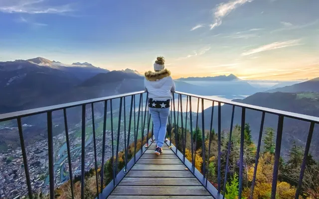
Interlaken's local mountain at 1,322 m, with the two-lakes viewing platform and a 360° view of Eiger, Mönch and Jungfrau. The funicular has its own valley station, seven minutes' walk from Interlaken Ost — if you would rather climb the 750 metres yourself, allow two and a half to three hours.
Skip the hike if you are short on time — the funicular takes ten minutes and the view is identical.
Viewpoint Getting there: 17 min · On foot + funicular
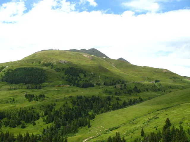
An alpine botanical garden at 1,967 m with around 800 plant species, reached by the 1893 cogwheel railway from Wilderswil. The panorama circuit takes around 2.5 hours and shows both lakes at once.
Closed outside 13 June to 25 October. Do not plan it for a spring or winter trip.
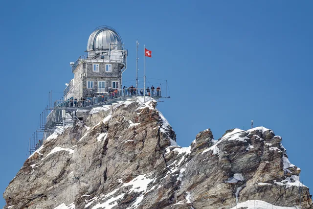
Europe's highest railway station at 3,454 m, with the Ice Palace, the Sphinx terrace and the Aletsch Glacier. The most expensive excursion in the region — and the only one that still works when it is raining in the valley.
The most expensive day in the region by a wide margin. Check the summit webcam before you buy — in cloud you pay a lot to see fog.
Mountain excursion Getting there: 97 min · Train
from CHF 38
Image: Paradise Chronicle · CC BY-SA 4.0
Grindelwald First
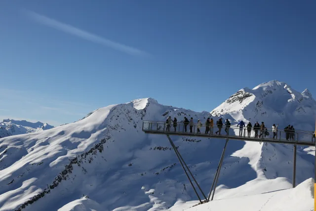
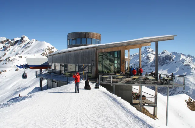
A 2,166 m viewpoint with the Cliff Walk and the trailhead for the walk to Lake Bachalpsee. The add-on attractions (First Flyer, Mountain Cart) are each paid for separately. The Mountain Cart hands over to the Trottibike at the Bort mid-station, which also has the alpine playground.
The cable car fare buys the view; Cliff Walk aside, every activity up there costs extra — Mountain Cart and Trottibike are CHF 25 each for adults, on a separate ticket.
Mountain excursion Getting there: 72 min · Train + bus + gondola
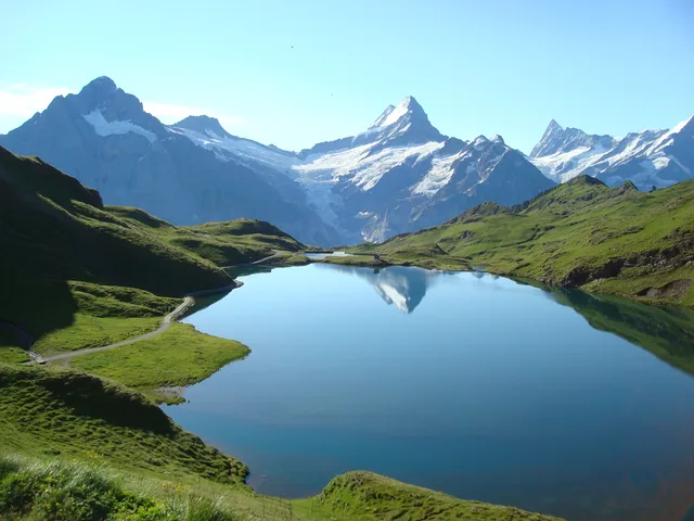
A mountain lake at 2,266 m below the Faulhorn, reached by cableway to First and about an hour on foot along an easy T1 path. There is no road and no lift to the lake itself.
The lake is free; the CHF 38 buys the cableway to the trailhead. Check the date first — the lift is shut for revision work from 26 October to 27 November 2026.
Mountain lake Getting there: 132 min · Train + bus + gondola + on foot
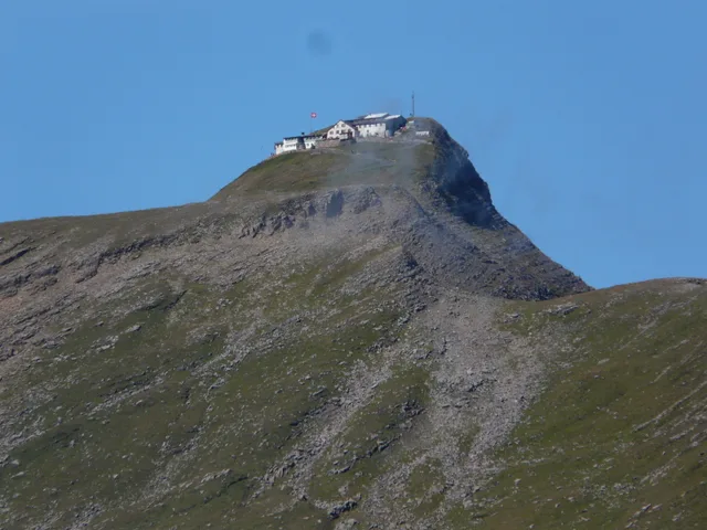
The high point between First and Schynige Platte at 2,681 m, and the only summit in the region with an inn from 1830 on top. No railway goes up — the last stretch is on foot, whichever way you come.
The Faulhorn is a hike, not an outing: the lift ends far below, and none of the sources publish a walking time in a form you could compare, so we do not print one. If you only want the view, the Bachalpsee gives you most of it for a fraction of the effort.
Summit with an inn from 1830 Getting there: 42 min · Train + bus to the valley station
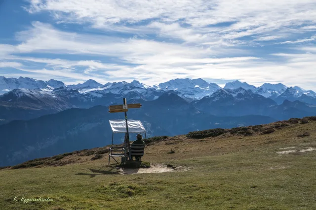
The pass at 1,962 m links Grindelwald with the Haslital valley — reached by a bus that runs from May to October, and facing the north walls of the Wetterhorn and the Eiger. Unlike most viewpoints in the region it is not a railway destination but a road.
The Grosse Scheidegg is a passage, not a summit: the bus stops at the top of the pass, and getting off and straight back on buys you a view and not much else. Its value is that it joins two valleys — as a leg between Grindelwald and Meiringen it is strong, as a destination in itself weaker than any of the region's railway viewpoints.
Pass between Grindelwald and the Haslital Getting there: 94 min · Train + bus
from CHF 36
Image: Kathrin Eggä · CC BY-SA 4.0
Niederhorn
The viewpoint above Lake Thun where, with a little patience, wild ibex can be watched. Much quieter than the destinations of the Jungfrau Region — and the best view of the north side of the lake.
The quiet alternative to the Jungfrau crowds. Getting there needs a bus and a cable car, so allow more time than the distance suggests.
Viewpoint Getting there: 63 min · Bus + two mountain railways
The highest viewpoint above Lake Brienz, reached by the only steam rack railway in Switzerland still carrying passengers to a timetable. From Brienz the climb takes 55 minutes — which makes the mountain a day of its own rather than a stop along the way, and its summit is also the point where the cantons of Bern, Lucerne and Obwalden meet.
The most expensive viewpoint on this list — and the only one where the operator answers the pass question differently in its two language versions: the English one names the Swiss Travel Pass four times, the German one not once, each occurrence sitting where the German says «GA» or «FIP-Ausweis». So the pass does buy the half fare — in one of the two versions. Reckon on CHF 49.00 rather than CHF 98.00 and ask before you buy. What travels free in both versions is the Bernese Oberland Regional Pass and the Lucerne Travel Pass. Add CHF 8.00 for the seat guarantee if you book ahead. If what you want is the view over Lake Brienz and not the steam engine, Harder Kulm gives it for a fraction of the price and a tenth of the travel time. If what you want is the steam engine, no other Swiss timetable has one — and you should reckon with the operator running diesel locomotives when it is busy or one breaks down.
Steam rack railway at 2,348 m Getting there: 81 min · Train
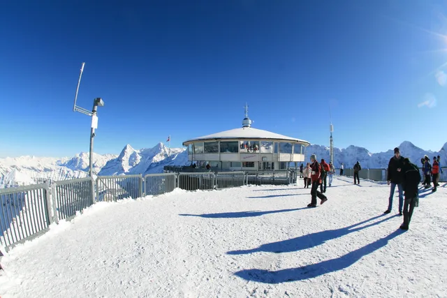
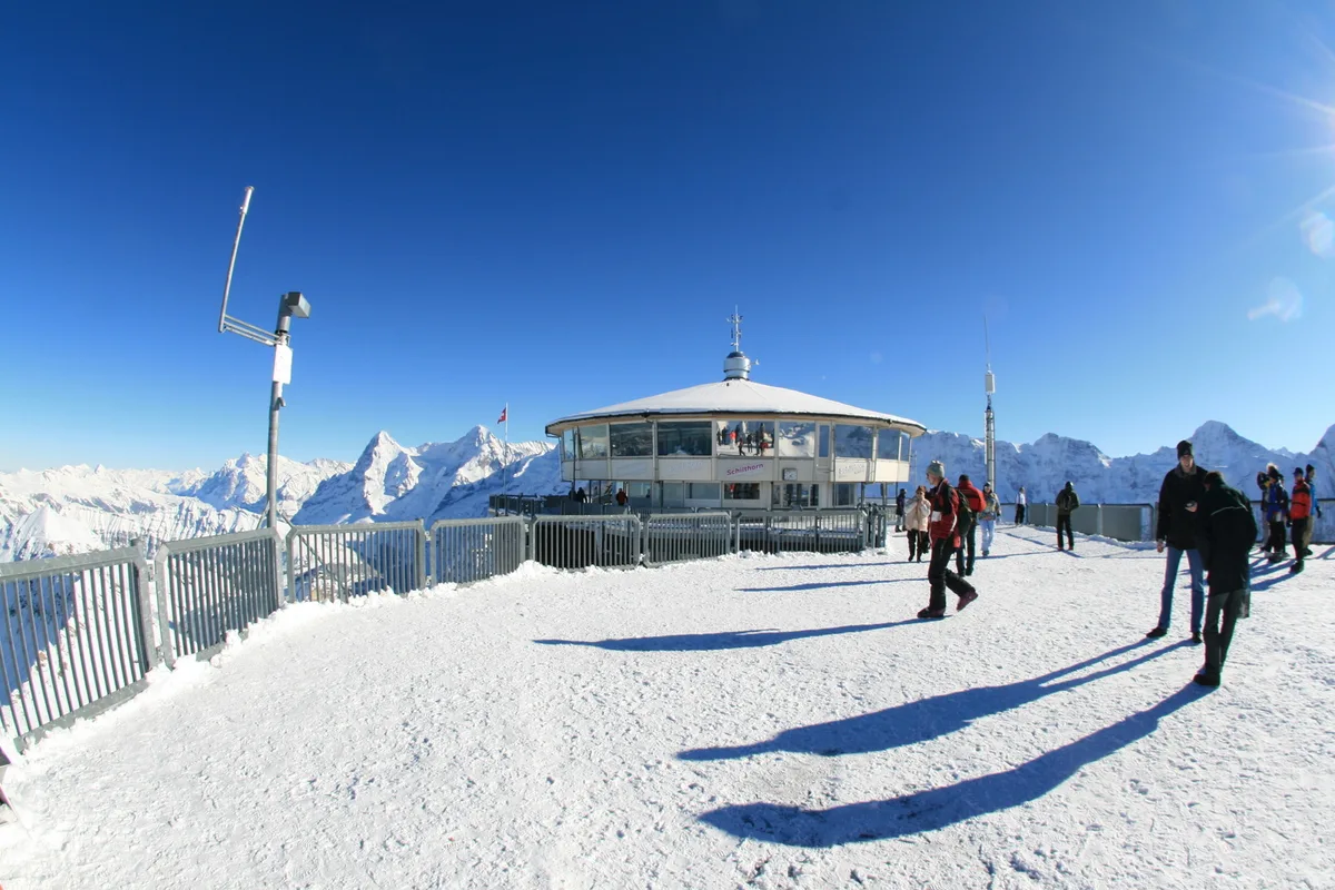
The 2,970 m summit with the revolving restaurant from On Her Majesty's Secret Service — and the second most expensive ascent in the region. If you only want height and a view, Mürren and Birg cost a fraction.
CHF 115 from Lauterbrunnen, CHF 135.20 from Interlaken. Worth it if the revolving restaurant and the 360° panorama are the point of your day; if you only want the view, Birg is the honest choice.
The funicular from Mürren climbs to 1,907 m in four minutes — to a playground, a flower trail and a panorama restaurant. The cheapest viewpoint the Schilthorn operator runs, and the first one where the Swiss Travel Pass does not travel free.
The Swiss Travel Pass and the GA do NOT travel free here: they cost CHF 8.00 return from Mürren, while the same passes pay nothing on the neighbouring Stechelberg–Mürren section. That is the costliest surprise on an otherwise cheap ride — CHF 16.00 return for adults, against CHF 91.40 up to the Schilthorn. Only the Berner Oberland Pass travels free. And the funicular stands still longer than you would expect: from 19 October to 11 December 2026 the Allmendhubel is closed while Mürren remains normally reachable.
Family hill above Mürren Getting there: 70 min · Train + bus + two mountain railways
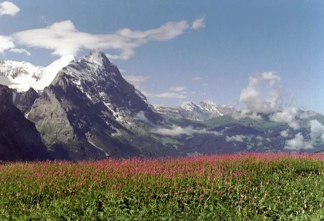
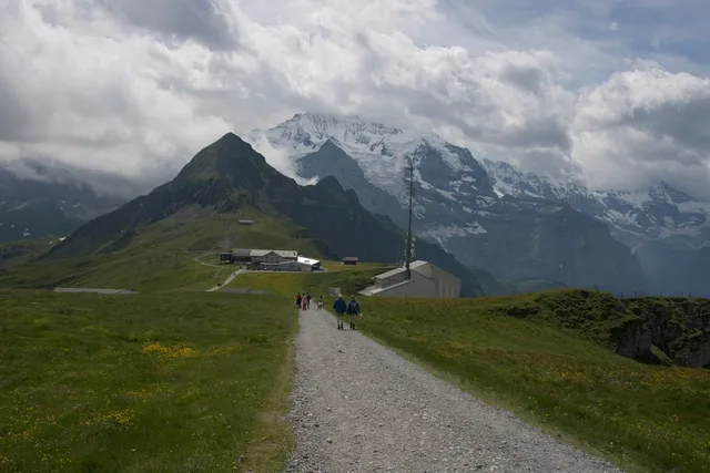
The railway junction at 2,055 m below the Eiger north face that every Jungfraujoch trip passes through. Get off instead of riding on and you stand closer to the wall than you would at the top — and the panorama trail to Männlichen starts at the same platform.
The honest comparison is with the Jungfraujoch you do not actually have to reach: 64 minutes instead of 97, 2,055 m instead of 3,454 — and the Eiger north face stands directly above you here rather than behind you. What the ride costs, though, the operator publishes nowhere we could check.
Pass and railway junction Getting there: 64 min · Train
A working alp at 1,804 metres above Grindelwald, reached only by mountain bus line 126 — no railway, no gondola. In summer the quieter approach to the Bachalpsee and the Faulhorn, in winter a sledging destination.
The dearest bus in this overview, and that is the point. Mountain line 126 is not a subsidised local service but the only road access to an alp: CHF 27.00 one-way and CHF 54.00 return from Grindelwald station, half that with a GA or Half Fare card. In winter the same ride costs CHF 40.00 and CHF 80.00 — the direction nobody expects — but buy the ticket on the spot, at the Bahnhofplatz sales point or from the driver, and it is CHF 30.00 and CHF 45.00. With a Grindelwald guest card the CHF 39.00 day ticket is the cheapest option and covers the Waldspitz line as well. What the Swiss Travel Pass is worth here the operator does not say: its fare page names only the GA and the Half Fare card. And in November nothing runs at all.
Alp above Grindelwald, reached only by bus Getting there: 73 min · Train + bus
The one viewpoint in the region served by two cableways from two different valleys — from Grindelwald Terminal and from Wengen, at different fares. The Panorama Trail to Kleine Scheidegg and the Royal Walk to the summit (2,342 m) both start at the top.
Two cableways climb the same mountain and they do not cost the same: CHF 68.00 return from Grindelwald Terminal against CHF 62.00 from Wengen — so the shorter approach from Interlaken is the dearer ride. The Half Fare travelcard, the GA and the Swiss Travel Pass pay half on the Grindelwald side; none of the three travels free. And the mountain stands still twice a year, not once: from 26 October to 11 December 2026 neither cableway runs, and after winter ends on 4 April 2027 neither runs again until summer starts — in 2026 the summer timetable began on 23 May, and the operator gives no date for 2027 yet.
One summit, two cableways Getting there: 54 min · Train + cableway
One destination up here is not a viewing platform but a walk: the
Bachalpsee, a lake at 2,266 m reached from the First
top station in about an hour on an easy path — with the caveat that the cableway to it is
suspended for revision work from 26 October to 27 November 2026.
If you would rather walk than ride: every route with distance, ascent, grade and the
travel time to its trailhead is on our hiking page.
The lakes, waterfalls and caves
Lake Thun and Lake Brienz were carved by the same glacier and look nothing alike: Brienz is colder, deeper and markedly more turquoise, Thun warmer and more built up. Scheduled boats serve most of the destinations in this group — and boats are the one thing here the Swiss Travel Pass covers in full.
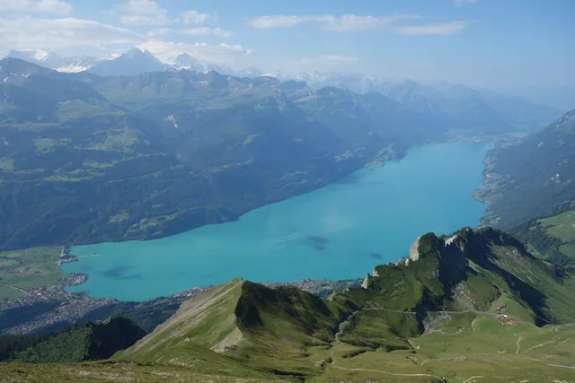
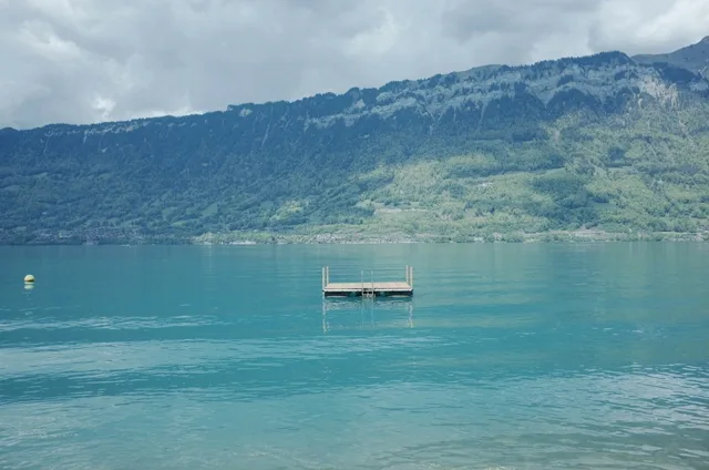
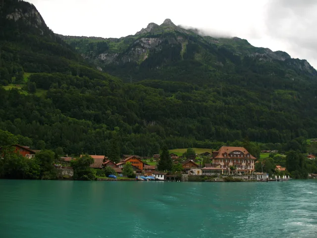
The turquoise lake east of Interlaken owes its colour to glacial rock flour carried in by its tributaries — the finest particles of rock, which scatter the light. A boat round trip, the lakeside path or a swim.
The turquoise only really shows in bright light. On a grey day the boat is still pleasant, the colour is not.
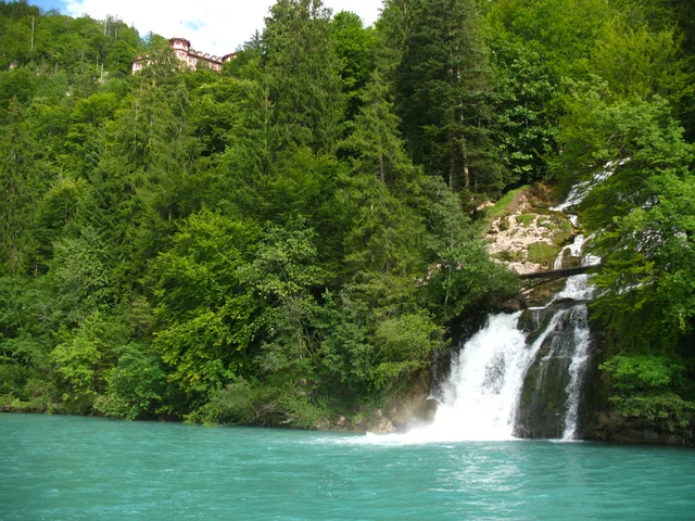
Fourteen cascades dropping some 500 m into Lake Brienz, with a path that leads behind the falls. You go up on Europe's oldest funicular of its type — or on foot from the boat pier.
The falls and the path behind them are free; only the funicular and the hotel cost money.
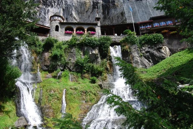
A kilometre of walkable dripstone cave above Lake Thun, open all year at a constant 8–10 °C. The most reliable rainy-day plan in the region — bring a jacket, even in August.
A constant 8 to 10 °C inside — bring a jacket even in August. The most reliable rainy-day plan in the region.
The fishing village on a peninsula in Lake Brienz, a pilgrimage site for K-drama fans since «Crash Landing on You». To see the jetty without a queue, come early in the morning.
Famous from the K-drama, and busy for it. Come before nine or after six if you want the jetty to yourself.
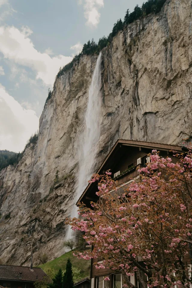
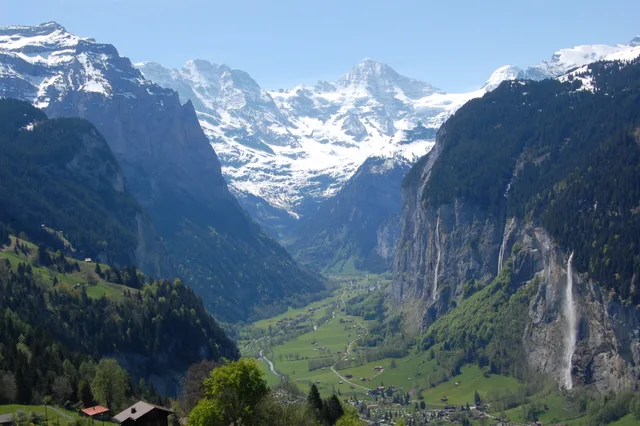
The valley where the Staubbach Falls drop 297 m free from the cliff — the highest free-falling waterfall in Switzerland — plus the Trümmelbach Falls inside the mountain. A classic half-day trip from Interlaken Ost, at its most impressive in early summer.
Busiest valley in the region by mid-morning. The waterfalls carry the most water in early summer.
Valley & waterfalls Getting there: 22 min · Train
CHF 21.00
Image: Bob Tan (Zuschnitt: LudwigSebastianMicheler) · CC BY-SA 4.0
The gorge the Lower Grindelwald Glacier has cut into the rock behind the village: walls 300 metres high, a walkway running about a kilometre in, plus a 170 m² net suspended seven metres above the Lütschine. Not to be confused with the Rosenlaui glacier gorge in the Haslital.
The gorge is a short, dense visit rather than a day's programme: the operator itself gives 1–2 hours for about two kilometres there and back. Three things the operator's own page does not put side by side. First the price: it advertises «Ab CHF 19.- / Gast», but that is the group rate for ten people or more — an individual pays CHF 21.00 admission. How much the guest card takes off the same page states twice, differently — the price block CHF 3.00, the FAQ answer above it «CHF 2.– Rabatt pro Person», a CHF 2.00 reduction —, so anyone holding one pays either CHF 18.00 or CHF 19.00, in the second case exactly the advertised figure and not less. Second the season: the same page says both «Ende April bis November» (late April to November) and «Mai November» (May to November), and no exact dates exist. Third the confusion: the Bernese Oberland has two glacier gorges, and the other one is at Rosenlaui behind Meiringen, some 11 kilometres away as the crow flies and with its own admission. What the Swiss Travel Pass is worth here the operator does not say, which is why the table reads «Not verified».
Gorge with walkways and tunnels Getting there: 53 min · Train + bus
In Interlaken and the villages
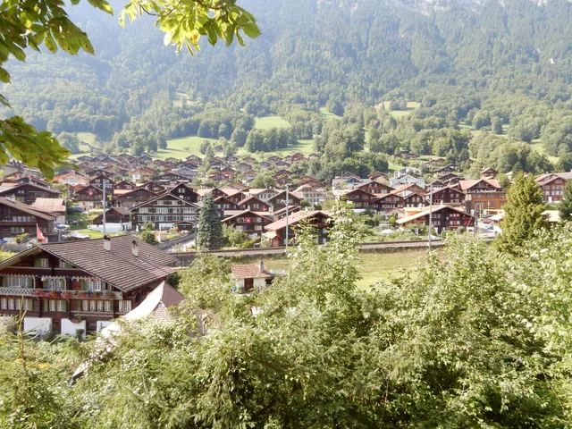
The town is often written off as a transit stop. That is unfair to the two things in it: a meadow protected from development since 1864, which is the only reason you can stand among hotels and still see the Jungfrau, and a medieval old town across the river that almost nobody visits. Beyond them are the villages — not summit stations but places to walk around, from Ringgenberg ten minutes up Lake Brienz by bus to Mürren and Gimmelwald high above the Lauterbrunnen valley.
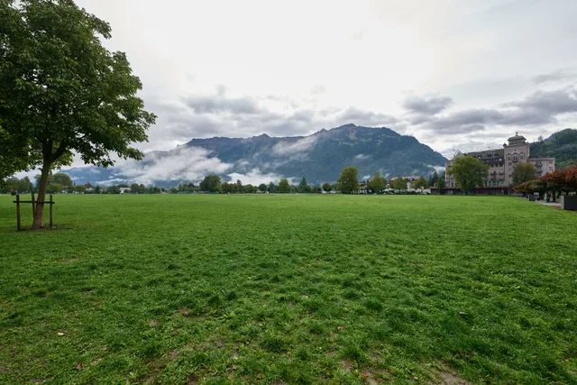
The 14-hectare meadow in the middle of town has been protected from development since 1864 — which is why in Interlaken you stand between hotels and still look freely at the Jungfrau. The paragliders land here too.
Not an attraction so much as the reason Interlaken has a view at all. A short walk, and free.
Park & landing field Getting there: 11 min · On foot
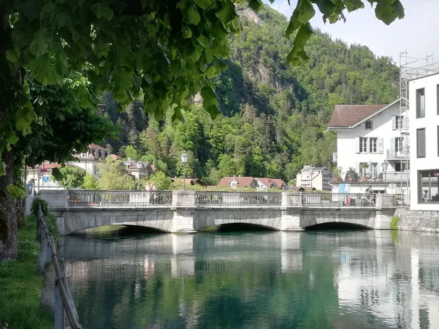
Just across the Aare lies the old town of Unterseen, founded in 1279, with what is probably the most photographed church tower in the Bernese Oberland. Ten minutes on foot from the Höheweg crowds — and almost empty.
Ten minutes from the Höheweg crowds and almost empty. Nothing to book, nothing to pay.
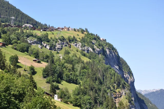
The car-free village on the sunny terrace above the Lauterbrunnen valley, facing the Jungfrau. Reachable only by cog railway from Lauterbrunnen — the car stays in the valley, and that is the whole point.
The village itself costs nothing and is 37 minutes from Interlaken Ost — the expense starts above it. Right place for a quiet sunny terrace facing the Jungfrau, wrong place if you expect bustle. What the ride costs, though, the operator publishes nowhere we could check.
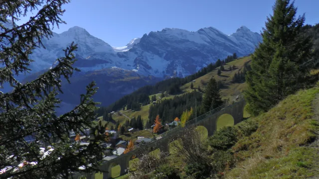
The car-free village at 1,649 m, beneath the wall of Eiger, Mönch and Jungfrau rather than facing it. Unlike Wengen it has no road to the valley at all — two mountain railway routes lead up, and they are not equally quick.
Two ways up, and the obvious one is the slower: 50 minutes from Interlaken Ost via Grütschalp, 66 via Stechelberg. From 19 to 30 October 2026 the Stechelberg side shuts for maintenance and only Grütschalp remains. What the BLM route costs, nobody publishes in checkable form.
Car-free village Getting there: 50 min · Train + cableway
The hamlet at 1,367 m on the first section of the Schilthorn cableway — car-free like Mürren, but with no row of hotels and no lift of its own. Only about every second Stechelberg–Mürren departure calls here; the fast Schilthorn connections run straight past.
For Gimmelwald on its own the Schilthorn operator publishes no fare — only the through route Stechelberg–Mürren is listed (CHF 11.80 one way, CHF 23.60 return). The stop lies on that route; what it costs by itself is nowhere stated in checkable form. From 19 to 30 October 2026 the section closes for maintenance, and Gimmelwald cannot be reached from Stechelberg at all.
Car-free hamlet Getting there: 54 min · Train + bus + gondola
Ten minutes by bus along Lake Brienz stands a church built inside the walls of a castle ruin — open, free, and with published opening hours no guidebook carries. Since 2009 a small lift spares you the climb up the steps.
This is a half-hour destination, not a day trip — and that is exactly its value: a ten-minute bus ride from Interlaken Ost, hourly at eight minutes past, no change. No ticket, no turnstile, no mountain railway. The parish publishes opening hours (7:30 to about 20:00 in summer) that appear on none of the tourism pages, and since 2009 a lift for four people runs up to it — making the Burgkirche one of the few destinations in the region reachable without steps. What is NOT stated here: the year the church was built. Neither the parish nor the municipality gives it, and it is not guessed.
Church in a castle ruin Getting there: 10 min · Bus
The fourth hamlet of the Lauterbrunnen valley, on a terrace at 1,078 m — reached by postbus, not by a mountain railway. The cableway up to Sulwald belongs to a cooperative in the village. The bottleneck is not the distance but the bus interval.
Isenfluh is not a panoramic summit and does not try to be — it is a residential hamlet with a cableway. The reason to go is that almost nobody gets off here, while on the other terraces of the same valley the trains to Wengen and Mürren run full. What this page says that the operator's own site does not: the bottleneck is the bus interval, not the cableway. The postbus from Lauterbrunnen mostly runs hourly at 35 minutes past, but on the Wednesday measured it skips 10:35, 11:35 and 14:35 — after 09:35 the next one is at 12:05, after 13:35 at 15:35: two and a half hours and two hours in the middle of the day. And the last cableway trip at 18.15 lands AFTER the last fast connection home, which leaves the village at 18:13; take it and the journey back is 69 minutes instead of 41. Not verified: the Swiss Travel Pass. The cooperative's price page names only the Berner Oberland Pass, and nothing is guessed here.
Hamlet with its own cableway Getting there: 38 min · Train + bus
A mountain village of 94 residents in a dead-end valley above Wilderswil — by population the smallest municipality in the Bernese Oberland. Five buses a day serve it on weekdays, four at the weekend — and the last one down leaves before the last one up arrives.
Saxeten is not a serviced attraction but an inhabited mountain village at the end of a dead-end valley — and planning a day here without knowing that goes wrong. Three things neither the municipality nor the tourist board puts side by side: first, from Monday to Friday exactly FIVE buses run up, with gaps of over three hours in the middle of the day — on Saturday and Sunday there are only four, and at different times. Second, the last bus down leaves at 16:51 while the last bus up does not arrive until 18:03 — take it and no postbus will bring you back that day; at the weekend the pattern is the same. Third, the village's only hospitality business, the Hotel Alpenrose with the Restaurant Pintli, has closed permanently: «Aus diesem Grunde schliessen wir das Restaurant und das Hotel Alpenrose nun dauerhaft.» So bring your own food. And the village is not to be confused with the Saxetbach gorge further down near Wilderswil where the canyoning tours run — that is a different destination, at 850 m.
Smallest municipality in the Bernese Oberland Getting there: 29 min · Train + bus
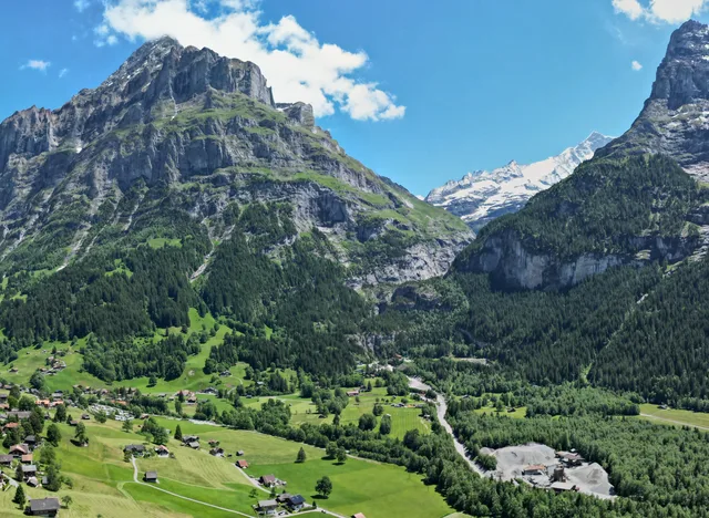
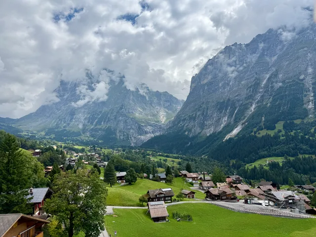
The village at 1,034 m below the Eiger north face — and the junction from which First, Männlichen, Grosse Scheidegg, Bussalp, Kleine Scheidegg and the glacier gorge are all reachable. Trains from Interlaken Ost run every half hour and always take 36 minutes, without a change.
The village itself costs nothing, and the 36 minutes from Interlaken Ost are the same on every departure — measured at eight departure times between 06:00 and 20:00, each one without a change. Among the destinations on this site that is the exception rather than the rule; elsewhere it pays to check the connection. The expense starts above: Grindelwald is a junction more than a destination, and every railway leading up from it is paid for separately. If you only want the village and the Eiger north face, a train ticket and an afternoon are enough.
Village below the Eiger Getting there: 36 min · Train
Further out in the Bernese Oberland
Almost every Interlaken guide, this one included, used to stop at the edge of the Jungfrau
Region. That works for two days and starts to fail on the third, when the mountains have been
done and the answer to "what now" is another cableway.
These seventeen are all reachable and
back in a day on the same trains, and none of them is in the Jungfrau Region at all.
They also answer different problems. The Oeschinensee, the Alpen tower above Hasliberg and the
Engstligenalp each want a full day — the Engstligenalp is the longest journey on this page, two
hours and four changes each way, and the table says so. The Aare Gorge is a rain destination —
inside a limestone slot the weather above is largely beside the point — and the Rosenlaui gorge
is the same idea an hour further out and a good deal quieter. Thun and Brienz are towns, which
after four days of alpine scenery is a feature rather than an apology. The Blausee takes two
hours, and it is the only lake in the region you pay to look at. The Reichenbach Falls are the one entry here that people seek out for a story rather than
for the thing itself — and the one whose funicular runs only from May to October. And the
Sigriswil Panorama Bridge is the shortest visit on the page at fifteen minutes — but the only
destination whose operator explicitly names prams and wheelchairs.
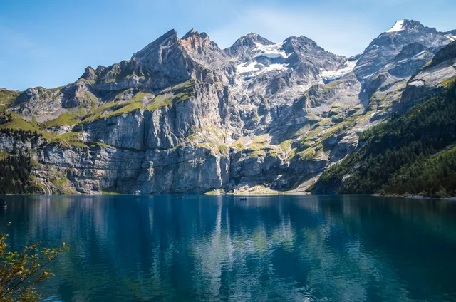
The turquoise mountain lake above Kandersteg, walled in by the Blüemlisalp and part of the Swiss Alps Jungfrau-Aletsch UNESCO site. The gondola does not reach the shore: the last 30 minutes are on foot, and only on foot — bikes and e-bikes are banned on the path by court order.
A good two hours each way means a whole day, not a stop on the way to something else. The fare is seasonal — CHF 40 return from 15 June to 21 September, CHF 36 either side of that; with a Half Fare card, a GA travelcard or a Swiss Travel Pass it is CHF 22.50 in high season and CHF 18.50 either side. In spring the gondola does not run at all, which turns the trip into a 90-minute walk up from Kandersteg.
Mountain lake Getting there: 123 min · Train + bus + gondola
CHF 13
Image: dconvertini · CC BY-SA 2.0
Aare Gorge
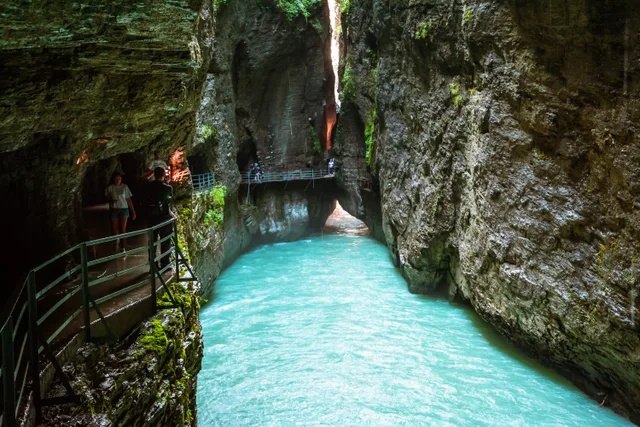
A 1.4-kilometre slot the Aare has sawn into the limestone between Meiringen and Innertkirchen. The path runs on walkways through the gorge itself, and the operator states that the stretch from the west entrance to the main features is passable by wheelchair.
After the St Beatus Caves this is the region's most reliable bad-weather destination — there is barely any sky visible inside the gorge, and the operator advertises it for any weather. The two entrances do not open on the same date: west from 3 April, east only from 9 May, both until 1 November 2026. What the Swiss Travel Pass is worth here the operator does not say; the Interlaken and Brienz guest cards give 20 per cent.
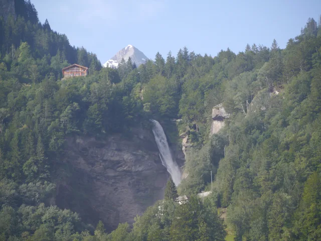
The waterfall above Meiringen that Arthur Conan Doyle made the scene of Sherlock Holmes's death in 1893. A funicular dating from 1899 runs to the brink from May to October; come outside the season and the falls are unchanged, but the railway is shut.
This waterfall is famous because of a story rather than its size — people search for the setting and find a waterfall where the ride up takes seven minutes and the stop at the top is short. It still carries a half-day, but through its neighbours: the Aare Gorge and the Rosenlaui glacier gorge are in the same valley and fit onto the same day. What the Swiss Travel Pass is worth here neither the operator nor the pass page says, which is why the table reads «Not verified».
Waterfall with a funicular Getting there: 63 min · Train + bus + funicular
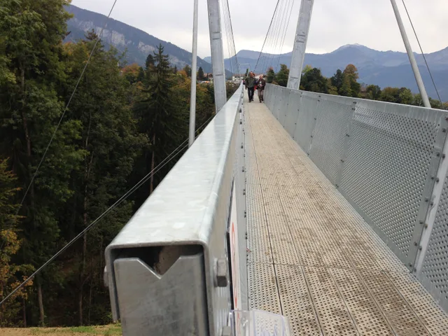
A 340-metre suspension bridge on the northern shore of Lake Thun, linking two parts of Sigriswil across the Gumi gorge — 182 metres above it, according to the operator. It is neither a mountain railway nor a summit: you walk across, see the lake side-on, and are done in a quarter of an hour.
A short visit: the bridge takes a quarter of an hour to cross, and after that the outing is essentially over. It fills a half-day only together with the Gumi gorge circuit (1.3 km, about 45 minutes per the operator) or a boat trip on Lake Thun. In exchange it is one of the most accessible destinations on this list — the operator explicitly names prams and wheelchairs — and with an Interlaken guest card it costs CHF 6.00 rather than CHF 8.00.
Suspension bridge over the Gumi gorge Getting there: 52 min · Bus
The village on the sun terrace above the north shore of Lake Thun, and the starting point of the Niederhorn cableway. The view across the lake to the Eiger, Mönch and Jungfrau costs nothing beyond the journey here — which sets it apart from most viewpoints on this list.
The cheapest big lake view in the region, and the only place on this list where three price tiers sell the same panorama: the village itself is reached on an ordinary zone ticket — CHF 8.00 from the lake on the Beatenbergbahn funicular, or a bus fare from Interlaken West. Only the Niederhorn summit costs money worth the name, CHF 49.00 return from the village or CHF 65.00 from the lake. If what you want is the Eiger, Mönch and Jungfrau across Lake Thun, you already have it on the terrace; if you want the ibex and the wide view over the pre-Alps, you pay for the ascent. The village is strung out along its road rather than gathered around a square — there is no old town here, just a street with a view.
Sun terrace at 1,215 m Getting there: 44 min · Bus + funicular
from CHF 11
Image: Shesmax · CC BY-SA 4.0
Blausee
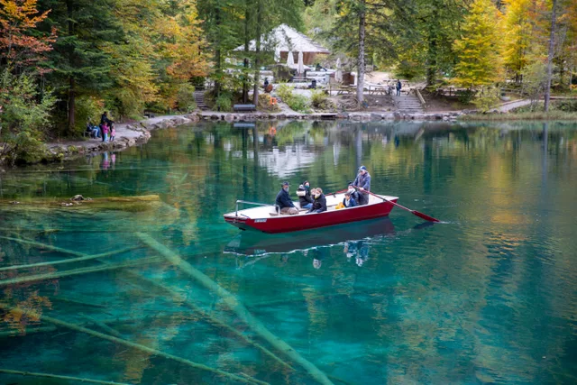
A small mountain lake in the Kander valley, its water so clear that tree trunks lying twelve metres down look as though they float just below the surface. The lake sits inside a fenced nature park with a trout farm — you pay to get in, which is what sets it apart from every other lake on this list.
The lake is small and two hours will do it — anyone expecting a day's walking is better served at the Oeschinensee. Entry is CHF 11 on weekdays and CHF 13 at weekends and on public holidays, two francs less after 17:00. It opens daily at 09:00, all year. Whether the Swiss Travel Pass reduces anything here the operator does not publish.
Nature park Getting there: 72 min · Train + bus
Free
Image: Daniel Reust · CC BY-SA 4.0
Thun
The town at the far end of Lake Thun, with a twelfth-century castle above the old town and a main street whose shops sit on the first floor — the pavements run along the roofs of the cellar storeys. The most urban place the region has.
The antidote to one mountain day too many, and a better call than a cableway into cloud when it rains. The town itself costs nothing; only the castle museum charges admission. Coming by scheduled boat instead of by train takes several times the 34 minutes — but that journey is fully covered by the Swiss Travel Pass.
Old town Getting there: 34 min · Train
Free
Image: Richard Ziebold · CC BY 4.0
Brienz
The woodcarving village at the upper end of Lake Brienz, seventeen minutes by train from Interlaken Ost and so the closest of the destinations further out in the Bernese Oberland. The steam rack railway up the Brienzer Rothorn starts here, and the Ballenberg open-air museum lies just behind the village.
The village itself is walked in an hour — it earns the trip mainly in combination with the Rothorn railway or the Ballenberg museum, and both cost extra. The steam railway charges CHF 63 up and CHF 98 return according to the operator (checked 06.08.2026); what the open-air museum charges was not checked at source, so it is not stated here. On travel time it is the opposite of the Oeschinensee: nothing on this list is closer.
Village Getting there: 17 min · Train
CHF 57
Image: Raimond Spekking · CC BY-SA 4.0
Hasliberg – Alpen tower
The sunny terrace above the Haslital valley, across from Meiringen. Three lifts in succession climb from Meiringen to the Planplatten top station at 2,204 metres, where the Alpen tower stands; the high-level paths towards Mägisalp and Käserstatt meet up there.
The price is a hiking day pass, not a ticket: Meiringen to the Alpen tower is CHF 57, CHF 40 with a Half Fare card, CHF 28.50 for children. Only the bottom cable car, Meiringen–Reuti, sells a return ticket — CHF 18.80, free with a GA travelcard; above Reuti there are one-way rides (Meiringen to the Alpen tower CHF 47.40 each way) and day passes, but no return. What the Swiss Travel Pass is worth here the operator does not say. The lifts run from 13 June to 25 October 2026, the top one only between 9.00 and 16.30.
Mountain terrace Getting there: 89 min · Train + cableway
CHF 12
Rosenlaui Glacier Gorge
The gorge the Rosenlaui glacier has milled into the limestone, high in the Reichenbach valley behind Meiringen. Walkways and tunnels cut into the rock lead past pools and waterfalls; the postbus stop carries the gorge's name.
The third gorge on this page, up in the Reichenbach valley and quieter than the other two. Adults from 16 pay CHF 12, children from 6 to 15 CHF 6, under 6 free; the Interlaken guest card and the Jungfrau Region guest card bring it down to CHF 10. The Berner Oberland Pass the operator lists separately from those, under «Individuelle Ermässigungen» — individual reductions — and names no amount there. Open from 14 May to 18 October 2026, 9 to 18 until 30 September and to 17 after that. Whether the Swiss Travel Pass helps here the operator does not say.
Gorge Getting there: 79 min · Train + bus
CHF 39
Image: Cédric Trachsel · CC BY-SA 3.0
Engstligenalp and the Engstligen Falls
The high plateau above Adelboden, reached by cable car from Unter dem Birg. Down the rock faces below it the water drops 600 metres in two cascades, according to the operator.
127 minutes each way and four changes, more than the Oeschinensee, which lies up the same valley. Anyone with only one day free is better served there; this trip is for the plateau itself. Return fare CHF 39, children from 6 to 15 CHF 20, CHF 30 with a guest card. The summer cable car runs from 13 June to 18 October 2026. What the Swiss Travel Pass is worth here the operator does not say.
High plateau Getting there: 127 min · Train + bus + gondola
CHF 25
Image: Hadi · Public domain
Axalp
The mountain village on the terrace high above Lake Brienz, south of Brienz, the end of a postbus line and the foot of a chairlift. People come for the quiet and the view over the lake — and have to read the timetable: on a summer day the postbus from Interlaken Ost runs only five times.
The smallest price tag on this list and the most honest small print — but the timetable decides the day, not the price. The operator publishes exactly ONE amount: CHF 25 as a day ticket, CHF 12.50 for children, with no single fare and no season label. Beside it stands a sentence you rarely read at a Swiss mountain railway: no reduction with a Half Fare Card or a GA travelcard. One season ticket does count, and the operator puts it above the price: «Magic Pass gültig» is the first line of the same text block, with a heading of its own further down — and in winter the operator says the Brienz – Axalp postbus is included in the Magic Pass too. The journey costs more than the ticket: on a summer day only five services run from Interlaken Ost, the first at 08:04 and the last at 16:10 — and that one arrives at 17:13, while the chairlift closes at 17:15. The last bus back leaves at 17:14. Stay up there until closing and you miss it; that arithmetic is ours, from the timetable and the operating hours, and nobody has written it out. On top of that the condition that can cancel everything: the lift runs only in good weather, and it stands still from 12.00 to 12.30 over midday.
Mountain village above Lake Brienz, 1,436 m Getting there: 61 min · Train + bus
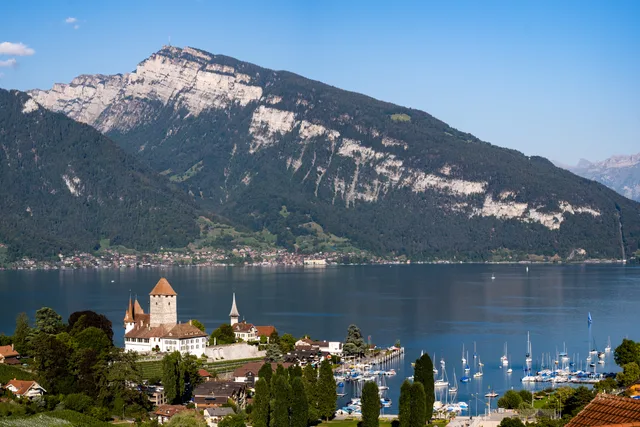
A castle of keep, manor house, Romanesque church and park, set on a spit of land reaching into the bay of Spiez. Museum and café keep a season from May to October; park and church are open year-round and cost nothing.
The destination splits into three parts and only one of them has a season. Museum, shop and castle café are open from 1 May to 31 October 2026 according to the operator, followed by a winter break until 30 April 2027; the castle park is open year-round and free, and so is the castle church — but the church is shut every Saturday all year and, during the winter break, on Sundays too. Come in winter and you will not find the gates locked — you will simply not see the museum, and at a weekend not the church either. The second planning trap is the way back: the boat from Interlaken West takes 1 hour 44 minutes and is the finer approach, but the last return sailing leaves at 16.08 while the museum stays open until 17.00. Boat out, train back is the more honest plan than boat both ways.
Castle on the bay of Spiez Getting there: 35 min · Train + on foot
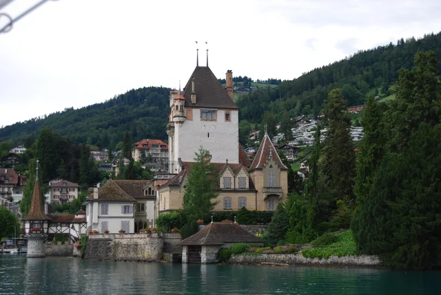
The castle sits on the north shore of Lake Thun with its keep reaching out into the water. The museum keeps a season from May to early November; the park is free and open from late March to mid-December.
The second castle on Lake Thun, and the question is rarely whether to go but which of the two it will be. Oberhofen is the further of the two (49 minutes against 35 to Spiez) and the dearer (CHF 15 against CHF 12); in return it has the keep standing in the water and a park that is free and open until mid-December. Two planning traps: the museum closes on 1 November, six weeks before the park does — after that there is only the grounds to see. And anyone arriving by boat should look at the way back first. The sailing from Interlaken West takes 1 hour 47 minutes because it works the southern shore as far as Spiez first, and the last one back leaves at 16.03 while the museum stays open until 17.00. Bus 21 runs straight along the northern shore and is there in 49 minutes from Interlaken Ost, every half hour and without a change.
Castle with a keep standing in the lake Getting there: 49 min · Bus
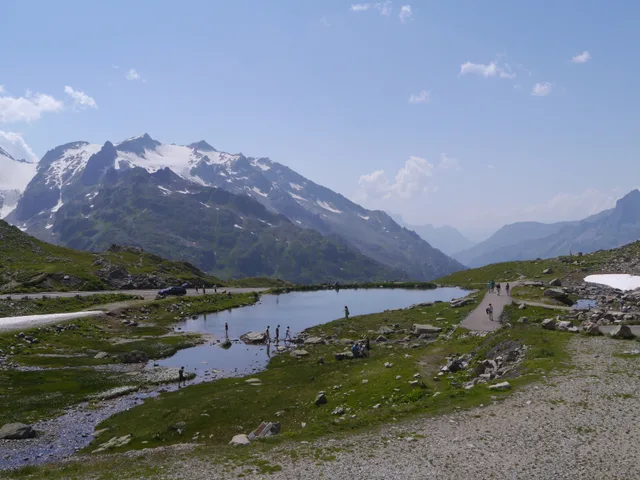
The pass summit at the eastern end of the Haslital, where the road up from Innertkirchen crosses the cantonal border into Uri. The furthest destination on this list that still works without a car — but on a summer day the timetable offers only two usable services up, and the last bus back leaves at 16:46.
The timetable makes this trip, not the pass. From Interlaken Ost the daily minimum is 116 minutes with one change at Meiringen — comparable to the Oeschinensee (123) and Engstligenalp (127), so the outer edge of what this site lists as a day trip. What decides the day is not the journey time but the frequency: on Wednesday 12 August 2026 there were exactly two usable services up — 08:04 arriving 10:10 with two changes, 12:33 arriving 14:29 with one — and the last one back left at 16:46, arriving 18:54. That produces an arithmetic nobody writes out: take the faster service and you get 2 hours 17 minutes at the top and spend 4 hours travelling. Take the early one and you get 6 hours 36. There is no third option. And the altitude quoted everywhere is not the altitude of the pass: 2,224 metres is the official «Strassenpass» point on the Uri side, while the point named «Pass» on the Bernese side lies 300 metres away at 2,259 metres. The season is now documented to the day: the PostBus runs for the last time on 4 October 2026 and returns on 19 June 2027 — which says nothing about when the road itself closes. Price and Swiss Travel Pass validity still could not be obtained from any primary source and therefore read «Not verified».
Pass summit between Bern and Uri, 2,224 m Getting there: 116 min · Train + bus
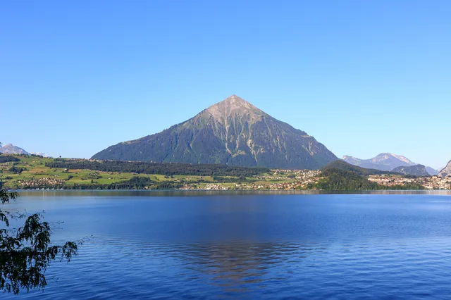
The free-standing pyramid between the Kandertal and Lake Thun, reached by a funicular from Mülenen. It climbs to 2,362 metres in two sections — and alongside the track runs the longest staircase in the world, 11,674 steps that nobody is allowed to walk.
The timetable here is the opposite of the Susten Pass: during the season the funicular runs every 30 minutes, daily, from 08:00 out of Mülenen to the last regular descent at 17:45, with evening services until 22:55 on Wednesdays, Fridays and Saturdays — so you can go on a whim without doing arithmetic on the way back. From Interlaken Ost the daily minimum is 83 minutes with two changes (Spiez and Mülenen), measured against the Swiss timetable for 16 September 2026. The real decision is what it costs: CHF 64 return — where that stands in the comparison, the Niesen page works out. The Swiss Travel Pass does not make it free: the operator lists it alongside the Half Fare travelcard and the GA under «Reduktionen», meaning half the fare; only the Berner Oberland Pass rides free, and the Magic Pass is expressly not accepted. And the staircase most people come to see is where nearly every travel report stops short: the 11,674 steps beside the track are, by the operator's own account, the longest staircase in the world — and «Das Betreten der Treppe ist verboten», entering the staircase is forbidden. Do it anyway and it costs 59 francs. It is open by four routes: with the «Stäge-Abo» season pass at CHF 490 or as a hired group — both between 03:00 and 07:00 — at one of the official evening staircase trainings, or at the annual stair race.
Pyramid above Lake Thun, 2,362 m Getting there: 83 min · Train + funicular
The second signature peak above Lake Thun, reached from Erlenbach im Simmental by a two-section cable car. A viewing platform with a glass floor panel is built into the north face — and unlike the Niesen, this railway also runs in winter.
The Stockhorn invites comparison with the Niesen, and almost every figure comes out close. The return fare is CHF 62 against CHF 64, the summit is the lower one at 2,190 against 2,362 metres, and both hang on a single railway off Lake Thun. The difference that actually decides a trip is winter: the Niesen shuts down in November, while the Stockhorn cable car keeps running daily from 3 December 2026 to 21 March 2027. That still does not make it year-round, and neither gap appears in any brochure: ten days between the timetables (23 November to 2 December 2026), and a second one in spring, because the winter timetable ends on 21 March 2027 and the summer one does not begin again until April — the operator gives no start date yet for 2027, and in 2026 it began on 11 April. The pass rules follow the same three-way split as the Niesen, and elsewhere they get shortened to a claim that mountain railways are included: the Swiss Travel Pass gives 50 per cent, the Berner Oberland Pass rides free, the Interlaken Guest Card gives 20 per cent — and the operator states plainly, «Die Reduktionen können nicht kumuliert werden», the reductions cannot be combined. What the Stockhorn has over the Niesen is access: by the operator's own account the viewing platform in the north face can be reached with a wheelchair or a pushchair, and from the Chrindi middle station the «No Limits» circuit runs around the Hinterstockensee, with off-road wheelchairs available for it. One quirk for anglers: the fishing permit is sold only together with a cable car ticket at the valley station, never up at the lake.
Viewing platform in the north face, 2,190 m Getting there: 93 min · Train + cableway
Two well-known names deliberately did not make this list. Kandersteg is not a
separate entry because it is the gateway to the Oeschinensee and appears in that journey
anyway. The Furka Pass and its steam railway are genuinely spectacular and
genuinely too far: the fastest public connection from Interlaken Ost to Realp is two hours
fifty-six minutes each way, which is not a day trip but a travel day.
Activities: what you do rather than look at
These 3 differ from everything else on this page in one respect: they are not
places but appointments. The reputation is earned — the Höhematte in the middle of town is
one of the few landing fields in the Alps where paragliders touch down every few minutes.
Prices, minimum ages and cancellations are set by the operators rather than the
destination, and apart from the boats no travel pass covers any of them.
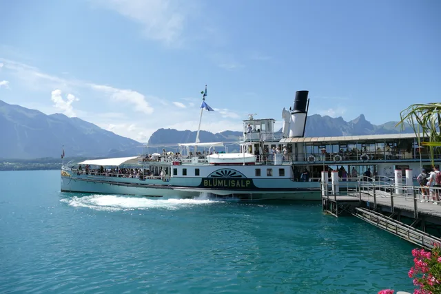
From the pier at Interlaken West the boats pass castles, vineyards and the St Beatus Caves on the way to Thun. The finest stretch lies between Interlaken and Spiez.
Fully covered by the Swiss Travel Pass and the GA — one of the few things here that is.
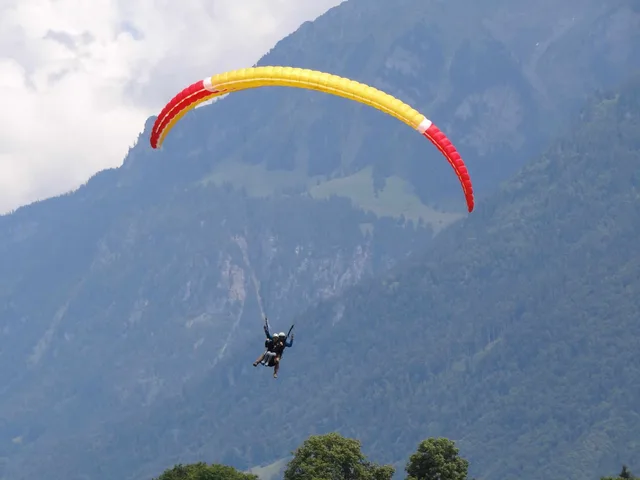
Tandem flights launch from Beatenberg or the Harder and land on the Höhematte in the middle of town. Depending on the thermals the flight lasts 10 to 20 minutes — flights are cancelled for wind and rain, often at short notice.
Weather-dependent and cancelled at short notice — book it for your first day, not your last.
Interlaken calls itself the adventure capital, and the gorges around Saxeten and the Lütschine are the reason. Operators pick you up in town; minimum age and swimming requirements differ from tour to tour.
Minimum ages and swimming ability vary by operator. Not a spontaneous afternoon.
Everything is open, including the Schynige Platte railway, which only runs from 13 June to 25 October. Long daylight makes a two-destination day realistic — a mountain in the morning, a boat in the afternoon. It is also the busiest period: Lauterbrunnen and Iseltwald are crowded by mid-morning.
Autumn — and what October actually looks like
October is the region's quiet reward: larches turning, clear air, far fewer people. It is also when things start closing. The Schynige Platte railway stops on 25 October, the Harder Kulm funicular runs until 29 November, and high trails can be snowed over from mid-month. Jungfraujoch runs all year. Grindelwald First does not: its gondola is shut for revision from 26 October to 27 November 2026. The St Beatus Caves call themselves open all year, but their summer season ends on 8 November and the winter season only starts on 21 November 2026.
Winter without skiing
You can spend several good days here without touching a ski. Jungfraujoch and Grindelwald First operate through the winter, the St Beatus Caves are the same temperature in January as in July, and boats still sail on Lake Thun. What closes is the Schynige Platte railway and, from late November, the Harder Kulm funicular — the platform is then only reachable on foot.
Honestly: not much. The Höheweg has bars and a casino, and in summer the last descent from Harder Kulm is late enough to watch the sunset from the platform before riding down. In high summer the Giessbach Falls are floodlit in the evening. Beyond that the town closes early, and that is worth knowing before booking a week here.
How many days do you need?
One day
Harder Kulm in the morning — seventeen minutes from the station, both lakes and the whole panorama in a single view, two to three hours all in. A boat on Lake Brienz in the afternoon, as far as Iseltwald or Giessbach. Jungfraujoch cannot be combined with anything; if you want it, it is the day.
Two or three days
Day two: the Lauterbrunnen valley with the Staubbach Falls, and if the weather holds, Schynige Platte. Day three belongs to Jungfraujoch — early departure from Interlaken Ost and nothing planned afterwards. Keep that day flexible rather than fixed, so you can move it to the clearest morning.
If it rains
The St Beatus Caves are open all year and identical in any weather, at a constant 8 to 10 °C — bring a jacket even in August. Jungfraujoch is the second option: with low cloud in the valley the train often climbs into sunshine. Check the summit webcam first, because under a high overcast there is nothing to see up there either.
With children
Harder Kulm (short ride, fenced platform), the St Beatus Caves (an adventure regardless of weather) and the boats work reliably. Schynige Platte suits slightly older children, for the alpine garden and the 1893 railway. Canyoning and tandem flights have operator minimum ages.
Without a cableway budget
Mountain railways are the largest line in an Interlaken budget. Without them there is still plenty: the Höhematte and the Unterseen old town, the shore paths on both lakes, Iseltwald, the Giessbach Falls and the path behind them, and Harder Kulm on foot — around 750 metres of ascent, two and a half to three hours, free. The Lauterbrunnen valley costs only the train fare.
Insider Tip
Harder Kulm is at its best in the late afternoon and at its busiest in the early one. Take one of the last ascents and the platform is almost yours at sunset — then ride down on the final descent, whose time is posted at the valley station each day.
Where to stay: Ost, West, Unterseen or Wilderswil
Stay near Interlaken Ost if your trip is mostly mountains — every train to Lauterbrunnen, Grindelwald and Jungfraujoch leaves from there, and early departures matter more than you expect. Interlaken West is quieter and closer to Lake Thun and its pier. Unterseen is a ten-minute walk from the centre, noticeably calmer and usually better value for the same standard. Wilderswil is one stop out on the Schynige Platte line and works well if you have a car.
What the Swiss Travel Pass actually covers here
Worth being precise about, because it changes the arithmetic. Scheduled boats on both lakes are fully included, as they are with the GA — a day ticket for Lake Thun and Lake Brienz otherwise costs CHF 83, or CHF 75 for Lake Brienz alone. Valley trains are covered. The mountain railways are only reduced, not free: Harder Kulm, Schynige Platte, Grindelwald First and Jungfraujoch all still cost money with a pass, and Jungfraujoch stays expensive. Add up the specific journeys you intend to make before deciding.
Frequently Asked Questions
How many days do you need in Interlaken?
Two full days cover one mountain, one lake and the town itself. Three is the honest figure if you want to add Jungfraujoch, because that trip fills a day on its own. Plan four or five if you intend to hike — weather windows in the Bernese Oberland rarely hold for three days straight.
Is Interlaken worth visiting?
As a base, yes: it sits between two lakes with rail connections to Lauterbrunnen, Grindelwald and Jungfraujoch, and somewhere to eat in the evening. As a destination in itself it is modest — a resort strip and a protected meadow. Almost everything people come for is a train ride away, and Interlaken is the most convenient place to catch that train.
What is the difference between Interlaken Ost and Interlaken West?
Interlaken Ost is the mountain gateway: trains to Lauterbrunnen, Grindelwald and Jungfraujoch leave from there, the Harder Kulm funicular is across the road, and boats on Lake Brienz depart alongside. Interlaken West is closer to Lake Thun and its pier. The two stations are about 1.5 kilometres apart, roughly a twenty-minute walk along the Höheweg.
Is the Swiss Travel Pass worth it for Interlaken?
It depends on the trips you plan. Scheduled boats on Lake Thun and Lake Brienz are fully covered, and a day ticket for both lakes otherwise costs CHF 83 — two boat days alone are substantial value. The mountain railways are a different matter: they give a reduction rather than free travel, and Jungfraujoch stays expensive even with a pass. Add up the specific journeys before buying.
Interlaken or Grindelwald — where should you stay?
Interlaken if you want both lakes and the mountains, and a choice of restaurants after dark. Grindelwald if your trip is mostly about the high mountains and being at the lift early — but reaching the lakes from there is awkward. For a first visit covering the whole region, Interlaken wins on connections.
What can you do in Interlaken when it rains?
The St Beatus Caves are open all year and unaffected by weather, at a constant 8 to 10 °C. Jungfraujoch is the counter-intuitive option: when cloud sits low in the valley the train often climbs through it into sunshine — check the summit webcam first, because under a high overcast there is nothing to see up there either. Boats run in the rain, and the town has two small museums.
Is Jungfraujoch worth the money?
It is the most expensive day in the region, from CHF 129.60 and often considerably more, and it takes about an hour and forty minutes each way from Interlaken Ost. In clear weather it is genuinely extraordinary — a glacier, an ice palace and the view across the Aletsch. In cloud you have paid a great deal to stand in fog. Treat the webcam as part of the ticket price and keep the day flexible.
What are the best day trips from Interlaken?
Beyond the Jungfrau Region, four stand out and each solves a different problem. The Oeschinensee above Kandersteg is the most beautiful and the longest — a good two hours each way, so a full day. The Aare Gorge near Meiringen is 37 minutes away and works in the rain. Thun, 34 minutes, is a proper town with a castle when you have had enough mountains. The Blausee is a two-hour visit and the one lake here you pay to enter. The Furka Pass, which other guides list, is nearly three hours each way from Interlaken Ost — a travel day rather than a day trip.
What is there to do in Interlaken at night?
Not a great deal, and that is worth knowing before booking several nights. The Höheweg has bars and a casino, the last Harder Kulm descent runs into the evening in summer so sunset from the platform is possible, and in high summer the Giessbach Falls are floodlit. Beyond that Interlaken closes early — the region is built around daylight.
 from CHF 22