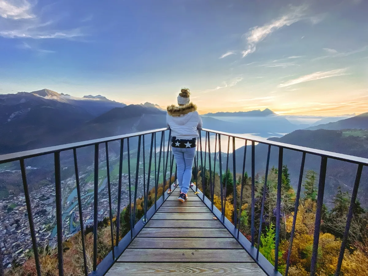
Three hikes, one summit
There are exactly two ways from Interlaken up to Harder Kulm: a marked mountain trail that takes about two and a half hours, and a funicular that takes ten minutes.
Most visitors end up using both — up on foot, down by rail. This page covers the walk in detail, and then separates the three quite different hikes that all get called “the Harder Kulm hike”.
At a glance
Chapter 01
Which of the three do you mean?
Search results mix these up constantly, and they demand completely different levels of ability:
1 — The climb from Interlaken Ost: the classic. Four kilometres, 750 metres of ascent, marked mountain trail. When someone says they hiked Harder Kulm, this is almost always what they did.
2 — The summit loop: for anyone who rode up and wants more than the platform. 2.3 kilometres, 131 metres of ascent, a little over an hour.
3 — The Hardergrat to Augstmatthorn: a different sport entirely. An exposed ridge, graded T3, for people with no fear of heights.
Chapter 02
The climb from Interlaken Ost
- Distance
- 4.1 km
- Time uphill
- 2:30–3:00 hrs
- Ascent
- +750 m
- Start
- Interlaken Ost, 567 m
- Highest point
- 1,323 m
- Best season
- April–October
Track from OpenStreetMap, elevations checked against the official swisstopo elevation service (largest deviation 3.3 m). It comes out at 4.0 km and 760 metres of ascent, which independently confirms the published 4.1 km and 750 m. Geodata © OpenStreetMap contributors, ODbL. As of 28 July 2026.
The trail starts opposite Interlaken Ost station, right next to the funicular valley station, and climbs from almost the first minute. It runs through the Bleiki forest for long stretches, which in midsummer is the single best thing about this route: shade. Technically there is nothing to it — waymarked throughout, no scrambling, no drop-offs. What makes it tiring is how relentless the gradient is, around 18 per cent on average, with barely a flat section to recover on.
How long it actually takes
This is worth a warning. Bergwelten puts this route at 3:50; other portals claim an hour and a half. Both are useless as a basis for planning. For 750 metres of ascent the usual rule of thumb is 300 metres per hour, which gives two and a half hours of actual walking, three with breaks. Do not plan the return on foot: the descent takes nearly two hours on the same trail and is far harder on the knees than the way up.
Getting to the trailhead
Trivially easy: the start is at Interlaken Ost, where every train from Bern, Lucerne and up the valley stops. There are car parks at the station, but they are beside the point — the route is not a loop, and anyone riding the funicular back down arrives at the station anyway.
Walk up, ride down
For the funicular the operator quotes from CHF 22 (checked 15 October 2026, source jungfrau.ch) for a single trip; up and back is CHF 44 — two single trips, with no return discount (queried in its booking flow, checked 9 August 2026). If you walk up, a single ticket down is all you need. Which travel passes reduce that, and by how much, is worth checking before you rely on it: the operator’s own Harder Kulm page names only its own products and publishes no Swiss Travel Pass figure at all. The full fare table is on jungfrau.ch.
More important than the fare is the last descent. It moves through the season and is posted at the valley station. Miss it and you are walking back down — in the dark, through the forest.
Insider Tip
Walk up, ride down, and start in the late afternoon. The trail is in shade by then, the summit is emptier than at midday, and you are on the platform for sunset. Just check the time of the last descent before you set off.
Chapter 03
How hard is it?
Graded T2 on the Swiss hiking scale: a mountain trail, waymarked, with no exposure and nothing to climb. That grade is about terrain, not effort — and the effort here is real. Reasonably fit walkers manage it comfortably; anyone who does not walk uphill regularly will find 750 metres of continuous ascent a serious morning. With hiking-accustomed children from around eight it is fine. For smaller children the climb is too long and too steep, and the summit loop after a ride up is the better plan.
Chapter 04
The summit loop
- Distance
- 2.3 km
- Time
- 1:15 hrs
- Ascent
- +131 m
- Start
- Harder Kulm top station
- Highest point
- 1,444 m
- Best season
- May–October
The round for anyone who came up by funicular and wants more than the viewing platform. It leads into the forest behind the top station and back over a ridge, with a hundred-odd metres of counter-climb. Easy, family-friendly and done in about an hour — the right choice when the full ascent is too much.
Chapter 05
The Hardergrat ridge to Augstmatthorn
A different undertaking, not an excursion. The ridge runs from Harder Kulm over narrow and repeatedly exposed sections over the Augstmatthorn to Alp Lombach, with both lakes far below on either side — 11.2 kilometres, 4:45 hours, graded T3, and according to Swiss Hiking Trails suitable only for people without a fear of heights. No water on the way, nowhere to stop, no way to cut it short. In wet weather or with a thunderstorm building it should not be started at all.
The name covers two quite different walks, though: the half that starts at Harder Kulm, and the full traverse from the Brienzer Rothorn that takes seven to ten hours and includes brief T5 sections. That is where the contradictory grades online come from. Both variants — with figures, escape routes, water and how to get there — are on their own page: Hardergrat Trail — two hikes, one name
Chapter 06
What to bring
For routes 1 and 2, sturdy shoes with grip, water and a windproof layer are enough — it is a waymarked trail, not high alpine terrain. The Hardergrat needs proper mountain kit: ankle-high boots, rain protection, enough water for five hours without a source, and an honest assessment of your own head for heights.
Frequently Asked Questions
How long is the hike from Interlaken to Harder Kulm?
Allow two and a half to three hours for the climb from Interlaken Ost. Published estimates are all over the place — Bergwelten puts the same route at 3:50, other portals claim an hour and a half — which makes most of them useless for planning. For 750 metres of ascent the standard rule of thumb is 300 metres per hour, so two and a half hours of walking, three with breaks and photo stops.
How do I get from Interlaken to Harder Kulm?
Two ways, and they start within fifty metres of each other. The trail begins opposite Interlaken Ost station, right beside the funicular valley station; the Harderbahn takes ten minutes to the top. Every train from Bern, Lucerne and the valley stops at Interlaken Ost, so neither option needs a car — and since the walk is not a loop, most people combine them.
Is Harder Kulm a difficult hike?
Not technically, yes physically. The trail is graded T2 — a marked mountain path with no scrambling and no exposure — and it stays in the forest for most of the climb. What makes it hard is the consistency: 750 metres over roughly four kilometres averages about 18 per cent, with almost no flat stretches to recover on.
Is Harder Kulm free with the Swiss Travel Pass?
Walking up is free; the funicular is not. On what the operator itself publishes we cannot give you a Swiss Travel Pass figure: its Harder Kulm page names only its own products — the Jungfrau Travel Pass and the Unlimited Jungfrau Summer Pass — and states no Swiss Travel Pass discount at all (checked 4 August 2026). Travel passes do reduce the fare, but by how much is not something the operator puts in writing on that page, so check the fare table before you count on a number.
How far is it, and how much ascent?
4.1 kilometres and 750 metres of ascent, from 567 m at Interlaken Ost station to 1,323 m at the summit. Our own GPX track, built from OpenStreetMap and checked against the official swisstopo elevation service, comes out at 4.0 kilometres and 760 metres — close enough to confirm the published figures independently.
Can I walk up and take the funicular down?
Yes, and it is what most people do. The descent on the same trail takes another two hours and is considerably harder on the knees than the climb. The one thing to check first is the last descent of the day: it shifts through the season and is posted at the valley station.
Route data: ascent and summit loop from Bergwelten, Hardergrat from Swiss Hiking Trails. Fares and ride time from jungfrau.ch. All retrieved 4 August 2026.
More routes around Interlaken, with distance, ascent and grade, are on our Interlaken hiking page. The mountain itself — funicular, opening season and the panorama restaurant — is on the Harder Kulm page.