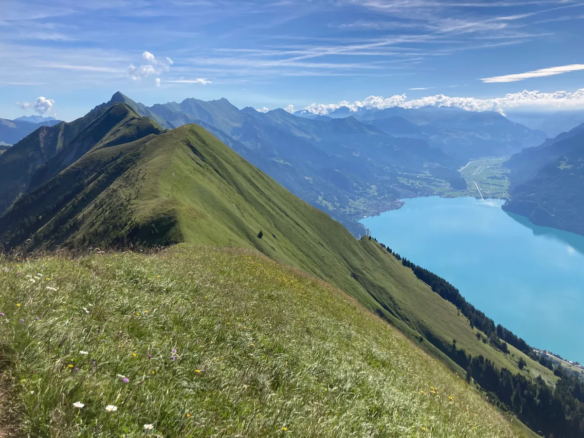
Look up the Hardergrat and you will find walking times from under five hours to over ten, and grades from T3 to T5. It reads like the sources contradict each other. They do not — they describe different walks that share one name. This page separates the two, gives the checked figures for each, and lists the places where you can get off the ridge.
Chapter 01
Two hikes, one name
The ridge between Interlaken and the Brienzer Rothorn runs for some 25 kilometres. In common use “Hardergrat” means both the whole traverse and the shorter western half that starts at Harder Kulm; the eastern part is often called the Brienzergrat instead. Read the figures for one and walk the other, and you will be out by a factor of two — in time, in ascent, and in the ability it takes.
| Key figures | Western half | Full traverse |
|---|---|---|
| Route | Harder Kulm – Alp Lombach | Brienzer Rothorn – Harder Kulm |
| Distance | 11.2 km | 25–28 km |
| Walking time | 4:45 hrs | 7–10 hrs |
| Ascent / descent | +1,075 / −820 m | from 2,348 m down to 1,322 m, with many counter-climbs |
| Grade | T3, exposed | T3–T4 with brief T5 sections |
| Ways off the ridge | none | several, all a long descent |
| Water on the way | none | none on the ridge |
| Source of the figures | Swiss Hiking Trails | brienzergrat.com |
Figures retrieved on 7 August 2026 from Swiss Hiking Trails and brienzergrat.com. The two sets are not convertible into one another — they belong to different routes.
Where the two variants run
Both variants to scale from the official coordinates of their summits. What is drawn is the crest line through the named points — not a track: no available trace of the Hardergrat matches the published key figures.
- Variant 1 · western half
- Variant 2 · full traverse
- Ways off the ridge
The line joins the named points of the ridge and is not a track — between two summits the path can run on either side of the crest. Crest line over 12 named points, 17.9 km as the crow flies between Harder Kulm and the Brienzer Rothorn — the walk itself measures 25 to 28 km according to brienzergrat.com. Coordinates from the swisstopo gazetteer, summit heights measured at the swisstopo elevation service, as at 17 August 2026. The heights of the two railway points are operator figures. The Ällgäulücke appears in no official register; its way down is therefore anchored at the nearest registered summit, the Ällgäuwhoren. © OpenStreetMap-Mitwirkende · Gelände © swisstopo
Chapter 02
Variant 1: Harder Kulm – Augstmatthorn – Alp Lombach
- Distance
- 11.2 km
- Walking time
- 4:45 hrs
- Ascent
- +1,075 m
- Descent
- −820 m
- Start / finish
- Harder Kulm / Alp Lombach
- Best season
- May–October
Terrain along the crest line, measured at the swisstopo profile service (queried 17 August 2026, a point every 90 m). The x-axis is the chord length over the named points — 9.1 km against 11.2 km of walking, because the path contours where the line cuts. Deliberately without a total ascent: the summed climb grows with the sampling density (measured +1,174 m at 60 points, +1,322 at 120, +1,428 at 240), which makes it a property of the grid rather than of the ridge. The figure that counts is the one from Swiss Hiking Trails above. One visible discrepancy while we are at it: the curve starts at 1,308 m where the table says 1,322 m — the first is the measured terrain at the Harder Kulm viewpoint, the second the operator's figure for the top station. The three summits in between — Roteflue, Suggiture, Augstmatthorn — hit their official height to within a third of a metre.
This is the one most people mean. It starts at the top station of the Harder Kulm funicular and runs over the Suggiture (2,085 m) to the Augstmatthorn (2,136 m), then down to Alp Lombach. Swiss Hiking Trails list it as an exposed ridge walk and state explicitly that it suits people without vertigo, with passages they describe as quite airy. Technically it asks for no climbing; what it asks for is sure-footedness for hours on end and a head that copes with the drop on both sides.
The 1,075 metres of ascent are misleading about the character of the day. They do not come in one climb but in a chain of ups and downs over the summits of the ridge. Anyone extrapolating their pace after the first hour will get the arithmetic wrong.
There is no way off. Between Harder Kulm and Alp Lombach no sensible path leads down into the valley — once you are up there, you walk the round out. That makes the forecast something other than a comfort question: in wet weather, or with a thunderstorm building, the ridge should not be started at all.
We deliberately do not offer a GPX file. The track a router produces from OpenStreetMap data for this route does not match the published figures: it returns 8.5 kilometres instead of 11.2, and more than half its line runs below 1,800 metres — it avoids the exposed ridge rather than following it. Shipping that under the name “Hardergrat” would send people onto a different route from the one described here. Take the national map and the waymarks.
Chapter 03
Variant 2: the full traverse from Brienzer Rothorn
- Distance
- 25–28 km
- Walking time
- 7–10 hrs
- Start
- Brienzer Rothorn, 2,348 m
- Finish
- Harder Kulm, 1,322 m
- Ways off
- several
- Best season
- September–October
The same measurement across the whole ridge: 18.6 km of chord against 25–28 km of walking. The saw between the Augstmatthorn and the Tannhorn is the part a single total time hides. As a cross-check rather than a figure: summed along this line the terrain climbs about 3,200 metres — novo-monde gives “just over 3,000” for their own crossing. The two agree in order of magnitude; trust the walker’s. Across the whole crest the ten summits between the two railway points hit their official height to within half a metre; those two points carry the operator's figures, which is why the curve starts 13.5 m below the 1,322 m given for Harder Kulm.
The whole crest, east to west. brienzergrat.com — run by Andy Davies, who lives at the foot of the ridge and has walked it more than fifty times — grades it “T3-4 with brief sections of T5 difficulty” and notes that about a quarter of the route is unmarked, though clearly defined along the crest. He also counts what the grade alone hides: at least four or five of the nine summits need short sections of climbing. novo-monde, whose report ranks near the top for this search, walked a 24.2-kilometre variant with just above 3,000 metres of ascent and 1,400 of descent, and places the hardest ground immediately after the Tannhorn.
The two hardest sections are secured, and almost no trip report says so. The T5 rock step onto the Tannhorn has a wire rope marking the safe line, and the final climb to the Augstmatthorn is secured with chains. That does not make this a via ferrata, and it does not make it easy — Davies describes the Tannhorn crest as steep, narrow and unnerving, with nowhere to let another walker pass. But “T5” read without that detail sounds like unprotected climbing, and it is not.
The difference from the western half is not only length. This side carries a T5 grading — ground where a slip stops being correctable — and the hardest of it arrives after several hours of walking, not at the start. Plan it as a mountain day, not as a long hike.
And then the railway operator says the route does not exist. On the hiking page of the Brienz Rothorn Railway, in as many words: “There is no official hiking trail from the Brienzer Rothorn to the Harder Kulm (or vice versa). The hiking trail ends at the ‘Chruterepass’ — there is no official route via Tannhorn – Allgäu Lücke to Blasenhubel.” The railway, the Berghaus Rothorn Kulm and Brienz Tourism do not recommend walking that section and state that they give no information about the condition of the path; it is not inspected. Anyone going anyway should, in their words, be in the best physical shape and an experienced walker, with ground that is absolutely free of snow and dry, sunny weather for at least two days beforehand, a day that is neither changeable nor windy — and should carry as much water as they can. They suggest hiring a guide.
Operator's own wording, quoted from the English edition of their hiking page and re-checked there on 23 August 2026: brienz-rothorn-bahn.ch/en/wandern. It is the sharpest sentence on this page, and none of the results ranking for “Hardergrat” carries it — not even those describing the crossing. It does not contradict the other sources: Swiss Hiking Trails list the western half as a waymarked mountain trail, and brienzergrat.com says of its own accord that about a quarter of the full traverse is unmarked. The operator only names which quarter — the stretch between the Chruterepass and the Blasenhubel, which on the profile above lies between the second and the eleventh mark.
Where you can leave the ridge
This is the information missing from most pages about the Hardergrat, and the only kind that counts when a day goes wrong. brienzergrat.com describes these ways down:
- Ällgäulücke — down to Oberried am Brienzersee on the lake side, or to Kemmeriboden on the other.
- Blasenhubel — steeply down to the lake shore.
- Suggiture — to Niederried in about 1.5 to 2 hours; the two fresh-water sources on this descent are the only ones anywhere near the ridge.
- Suggiture or Horet — over to Habkern in roughly 2 hours.
None of them is a shortcut. Each costs one to two extra hours of descent and ends somewhere other than where you planned, with its own way back to the valley.
A note on the figures for these descents: the author publishes his page in English and in German, and the two versions do not agree in every detail — the English one puts the Habkern descent at about two hours from the Suggiture, the German one from the Horet, and the summary tables differ from the running text. We give the range rather than pick the flattering end of it.
Chapter 04
Stages and split times
A total walking time tells you nothing about where you will be standing at two in the afternoon. Both sources publish split times — Swiss Hiking Trails for the western half, brienzergrat.com for the traverse. We put them side by side and add them up, which neither source does.
| Point | Stage | From the start | Height |
|---|---|---|---|
| Harder Kulm | — | 0:00 | top station, 1,322 m |
| Roteflue | 1:28 | 1:28 | 1,730 m |
| Augstmatthorn | 2:19 | 3:47 | 2,136 m |
| Alp Lombach | 0:58 | 4:45 | mountain inn, postbus |
| Point | Stage | From the start | Height |
|---|---|---|---|
| Brienzer Rothorn Railway | — | 0:00 | 2,348 m |
| Tannhorn | 2:00–3:00 | 2:00–3:00 | 2,221 m |
| Ällgäulücke Way off | 1:00–2:00 | 3:00–5:00 | — |
| Blasenhubel Way off | no separate split time | 1,965 m | |
| Augstmatthorn | 2:00–3:00 | 5:00–8:00 | 2,136 m |
| Suggiture Way off | 0:15 | 5:15–8:15 | 2,085 m |
| Harder Kulm Railway | 2:30 | 7:45–10:45 | 1,322 m |
Split times for the western half from Swiss Hiking Trails, for the traverse from the English edition of brienzergrat.com, both retrieved on 17 August 2026. Heights from the swisstopo elevation service, queried the same day at the summit points of the official gazetteer. For the Ällgäulücke no height is given here on purpose: the gazetteer does not hold the name at all — the notch carries it only in the usage of people who walk the ridge, so any figure would be a guess. Two of the author's own heights differ from the official ones — he gives the Augstmatthorn as 2,101 m against 2,136 m measured, and the Brienzer Rothorn as 2,348 m in one line and 2,349 m in another.
Adding the stages up shows two things neither source states. First, the author's own segment times come to between 7:45 and 10:45 — so the headline figure of “7 to 10 hours” is optimistic at its lower end by three quarters of an hour, before a single break. Second, the same stretch between Augstmatthorn and Harder Kulm takes 2:45 going down by his times and 3:47 going up by the Swiss Hiking Trails figures. Walk the western half from Alp Lombach instead of towards it and the table above no longer applies.
Chapter 05
Water
There is no spring and no refreshment on the ridge itself. novo-monde is unambiguous about it: refilling anywhere along the whole Hardergrat is impossible. The one qualification comes from the same author who recommends how much to carry — brienzergrat.com names two fresh-water sources at mountain huts, the first about twenty minutes below the crest, but they lie on the descent to Niederried. They will help you get down; they will not keep you on the ridge.
On quantity the two sources disagree, and the gap is wide: at least two litres, three if you can carry the weight (brienzergrat.com) against four to five litres per person (novo-monde) — on a cool September day. We do not average the two. One comes from more than fifty crossings, the other from a single one; both are experience rather than an operator's figure, and the difference says more about the day than about the route. At the end of the western variant stands the Jägerstübli mountain inn on the Lombachalp, the only place to stop on the whole stretch.
Chapter 06
Getting there and back
To the western half: the Harder Kulm funicular from Interlaken Ost, ten minutes to the top station. Swiss Hiking Trails point out what that is worth on this particular route — it saves 570 metres of ascent before the ridge even begins. Tickets are from CHF 22 according to the operator (checked 15 October 2026); the Swiss Travel Pass, the Half Fare Card and the guest card each reduce that differently, and jungfrau.ch carries the current table. Allow seven minutes on foot from Interlaken Ost station to the valley station, as the timetable does.
To the full traverse: train from Interlaken Ost to Brienz, 17 minutes and direct, then the Brienz Rothorn Railway. For 2026 the operator gives an operating season of 6 June to 25 October, with an adult fare of CHF 63 one way and CHF 98 return (checked 14 October 2026, brienz-rothorn-bahn.ch). And here is the trap the operator does not put up front: the earliest ascent at 07:36 runs only on Saturdays and Sundays in July, August and September. Plan the traverse on a weekday and you start later, with seven to ten hours ahead of you.
The way back is the underestimated part. From Alp Lombach to Interlaken Ost the timetable gives 64 minutes with two changes; from Habkern, Post it is 28 minutes with one, hourly. After four and a half hours on the ridge — let alone nine — that is more than most people build into the day, and the postbus service on the Lombachalp is thin.
Journey times measured on 7 August 2026 in the official timetable for a Wednesday in August 2026, taking the fastest connection across the day. The 23-minute connection the timetable also returns for Habkern is the 22:36 bus, which meets a fast train rather than the local one — it is not a figure anyone walking off the ridge will use.
Chapter 07
Season and cornices
Safety note
Swiss Hiking Trails give May to October. hardergrat.com, run by the same person as brienzergrat.com, is blunter: from November until the end of May the peaks are snow or ice covered, which makes them “extremely dangerous or impassable”. For the shoulder months the site warns about cornices — snow overhangs on the lake side of the crest that, by its account, can reach three to four metres and have nothing underneath them but a thousand metres or more of drop, and that can collapse at any time, particularly as spring warms up. That is an experienced walker's observation, not an official measurement, and we report it with its source.
novo-monde rates September and October the best months, and not because of snow: the ridge has no shade, and in July and August you carry the day's water up with you.
Insider Tip
If the full traverse is too much, the western half is not a consolation prize. It has the same drop to both lakes, the same summit view from the Augstmatthorn — and an end you can reach without planning for the dark. For less exposure again, walk the Augstmatthorn as a round from Habkern or the Lombachalp instead of following the crest its whole length.
Chapter 08
Easier alternatives — what is actually waymarked
If the full traverse is too much, there is more on offer than the western half. The railway operator publishes six numbered mountain routes for its own area with walking times — and unlike the crest between the Chruterepass and the Blasenhubel, those are official trails. We give their times unchanged.
| Route | Time | What it is good for |
|---|---|---|
| Summit path top station 2,244 m – summit 2,350 m | 0:15 hrs | The ridge without walking the ridge. The operator calls it manageable for the less well trained. |
| Brienzer Rothorn – Chruterepass – Planalp route 5 | 2:45 hrs | The only variant that follows the crest path as far as it officially goes, and turns off where it ends. |
| Brienzer Rothorn – Planalp route 3, steam railway up | 2:30 hrs | The direct descent — the walk novo-monde names as its alternative. |
| Planalp – Mettli – Brienz route 6 | 2:00 hrs | The continuation into the valley when the railway times no longer fit. |
| Brienzer Rothorn – Schönbühl – Turren route 1, on to Lungern | 3:00 hrs to Turren 5:00 walking on to Lungern | The high traverse east instead of west — panorama without the exposure. |
Route numbers and walking times retrieved 17 August 2026 from brienz-rothorn-bahn.ch/en/wandern, re-checked there on 23 August 2026 and unchanged. One thing that matters for planning: the same operator reports there that the trail Brienz – Planalp via the Milibachgraben remains closed after storm damage — route 6 over the Mettli is the way round it. On the summit height: the operator writes 2,350 m while the swisstopo elevation service measures 2,348 m at the summit point; the tables above carry the official figure and this one carries what stands on their page. On route 1 the operator contradicts itself: its table gives 3 hours to the Turren, while its own text on the same page gives about 2 h 30 to Schönbühl and about 1 h 30 from there to the Turren, «Wanderzeit ca. 4h» — about 4 hours walking in all. We give both figures and do not average them (checked 8 October 2026); if you need to catch the last Turren cableway, plan on the four hours.
The two alternatives on the Interlaken side are less well documented, and we say so. novo-monde names a round walk from the Lombachalp to the Augstmatthorn and the Suggiture of 6 km — no walking time or ascent from any source we could check, so none is given here. Bergwelten lists Harder Kulm – Augstmatthorn – Habkern at 15 km, 6 hours, +896 and −1,134 metres. That is not a shorter walk but the same western half with a different way home — and it comes with a different grade: Bergwelten says T2 where Swiss Hiking Trails say T3 for largely the same ground. If in doubt, plan for the stricter one.
Chapter 09
What is not allowed on the ridge — and from where
The crest runs through two federal game reserves. That is law rather than etiquette, and none of the pages ranking for “Hardergrat” says so. We queried the boundaries against the federal inventory instead of taking them from trip reports — and the answer differs from the version usually repeated.
| Section | Status | What it means |
|---|---|---|
| Harder Kulm and the first kilometre of ridge | outside | No reserve. The common claim that protection starts at Harder Kulm is wrong. |
| Suggiture – Augstmatthorn – Blasenhubel | Federal Game Reserve Augstmatthorn (no. 1, 2,012 ha, partial protection) | Drone flying prohibited; snow sports prohibited away from marked pistes, routes and trails. |
| Tannhorn | Federal Game Reserve Tannhorn (no. 5, 1,165 ha, integral protection) | The same, under the inventory's stricter category. |
| Tannhorn – Brienzer Rothorn | edge of the UNESCO Entlebuch Biosphere | No camping, no bivouac (brienzergrat.com). |
Boundaries queried point by point against the federal geodata on 17 August 2026 (api3.geo.admin.ch): the federal inventory of game reserves and biosphere reserves held by the environment office, drone restrictions held by the civil aviation office. The summits Suggiture, Augstmatthorn and Blasenhubel fall inside the Augstmatthorn reserve, the Tannhorn inside its own, and Harder Kulm inside neither. We sampled along the line joining the summits, not along the actual path — enough to assign sections, not enough for a distance figure, which is why none is given.
- Drones: prohibited, at every weight. The civil aviation office lists both reserves as a zone carrying the condition that operating unmanned aircraft is prohibited, on nature grounds. The Meiringen control zone lies over the Augstmatthorn as well, where drones above 250 grams may not fly higher than 120 metres above ground in any case.
- Snow sports away from marked routes: prohibited. The environment office records this provision as legally binding for both reserves. For anyone on snowshoes in spring it is the line on this page that matters most.
- No camping, no bivouac, no mountain bikes, dogs on a lead. These four come from brienzergrat.com and apply, in his account, to the whole route. They are not in the federal inventory we queried, so we report them with their source rather than as statute.
- Where zones overlap, the stricter rule applies. Over the Augstmatthorn the reserve and the control zone do exactly that.
Chapter 10
What to bring
Ankle-high boots with a proper sole, wind and rain protection, at least two litres of water, and the national map — specifically sheet 254T Interlaken of the 1:50,000 hiking map, which is the sheet Swiss Hiking Trails list for this exact route (checked 17 August 2026). For the full traverse add a head torch and an honest estimate of how long your own concentration holds on exposed ground — the T5 step comes after hours of walking, not at the start.
Frequently Asked Questions
How hard is the Hardergrat trail?
That depends on which half you mean, and that is the reason two different answers circulate. Swiss Hiking Trails grade the western half from Harder Kulm to Alp Lombach as T3 and call it an exposed ridge walk for people with a head for heights. The full traverse from Brienzer Rothorn is graded on brienzergrat.com as “T3-4 with brief sections of T5 difficulty”; those T5 sections lie after the Tannhorn, on the eastern half that the short variant never touches. Both gradings are correct — they simply describe different walks.
How long does the Hardergrat take?
The western half, Harder Kulm to Alp Lombach: 4 hours 45 minutes over 11.2 kilometres (Swiss Hiking Trails). The full traverse from Brienzer Rothorn: brienzergrat.com gives 7 to 10 hours over 25 to 28 kilometres on its English page and 7 to 9 hours on its German one. novo-monde walked a 24.2-kilometre variant with just above 3,000 metres of ascent. The spread between four and a half and ten hours is not uncertainty — it is three different days out.
Is the Hardergrat waymarked?
Only half of it — and the Brienz Rothorn Railway puts it most plainly: “There is no official hiking trail from the Brienzer Rothorn to the Harder Kulm (or vice versa). The hiking trail ends at the ‘Chruterepass’.” The western half from Harder Kulm, by contrast, is a waymarked mountain trail and appears as one in the trail network. In between, from the Chruterepass to the Blasenhubel, you follow a path of use; brienzergrat.com describes it as mostly clear but exposed, with a raised risk of slipping when wet, and puts the unmarked share at about a quarter of the route. The railway, the mountain inn and Brienz Tourism do not recommend that section and give no information about its condition. Anyone walking it takes the national map and relies on no waymark at all.
Are the exposed sections secured?
Two of them are, and this is the detail most trip reports leave out. On the T5 rock step up the Tannhorn a wire rope marks the safe line, and the final climb to the Augstmatthorn is secured with chains. Neither turns the route into a via ferrata — the author of brienzergrat.com, who has walked the ridge more than fifty times, calls the Tannhorn section steep, narrow and unnerving, with no room to pass. Everything between the secured bits is unprotected walking on a narrow crest.
Is there water on the Hardergrat?
Not on the ridge itself. novo-monde puts it plainly: it is impossible to refill anywhere along the whole ridge. The same author of brienzergrat.com who recommends carrying the water does name two fresh-water sources at mountain huts — but they are on the descent to Niederried, the first about twenty minutes below the crest, so they help you get down rather than keep you going. On quantity the two sources disagree: at least two litres, three if you can carry the weight (brienzergrat.com) against four to five litres per person on a cool September day (novo-monde). We do not average them.
Can you get off the ridge partway?
On the full traverse yes, at several points — and it is the single most useful piece of planning information there is. brienzergrat.com describes descents from the Ällgäulücke towards Oberried am Brienzersee or Kemmeriboden, from the Blasenhubel steeply down to the lake shore, from the foot of the Suggiture to Niederried in about 1.5 to 2 hours, and onward to Habkern in roughly 2 hours. On the short western variant there is no sensible way off between Harder Kulm and Alp Lombach: once you are on it you finish it.
When is the Hardergrat walkable?
Swiss Hiking Trails give May to October. hardergrat.com states that the peaks are snow or ice covered from November until the end of May, which makes them “extremely dangerous or impassable”, and warns about cornices in the shoulder months — snow overhangs that can be three to four metres high with nothing underneath but a thousand metres of drop, and that can collapse at any time, particularly as spring warms up. novo-monde rates September and October the best months, and for a different reason: heat and the water you would otherwise have to carry.
Do I need a head for heights?
Yes, and it is worth being honest with yourself before you are on the crest rather than after. Swiss Hiking Trails describe the western half as an exposed ridge walk suited to people without vertigo, with passages they call quite airy. Sure-footedness matters more than technique: nothing on the western half requires climbing, but the trail is narrow for hours and the ground falls away on both sides.
How do I get to the start, and back from the end?
For the western half, take the Harder Kulm funicular from Interlaken Ost — ten minutes, and it saves 570 metres of ascent according to Swiss Hiking Trails. For the full traverse, take the train to Brienz (17 minutes, direct) and the Brienz Rothorn Railway from there. Coming back is the part most people underestimate: from Alp Lombach it is 64 minutes to Interlaken Ost with two changes, and from Habkern, Post 28 minutes with one, hourly. After a long day on the ridge that is more than it sounds.
Figures for the western half from Swiss Hiking Trails, for the full traverse from brienzergrat.com and novo-monde.com, seasonal conditions from hardergrat.com. Summit heights for the Augstmatthorn and Suggiture from the swisstopo elevation service, journey times from the official timetable. All retrieved on 7 August 2026.
More routes around Interlaken, with distance, ascent and grade, are on our Interlaken hiking page