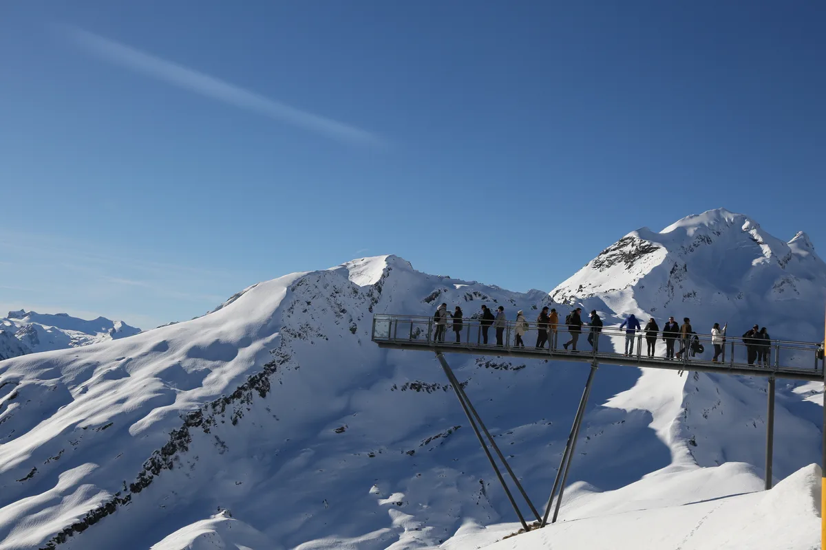
Grindelwald sits under the north face of the Eiger with four mountain railways running out of it, which makes it the easiest place in the Bernese Oberland to start a walk high up. That is also the thing most hiking lists forget to mention: here you usually walk down. Four of the five routes below start at a lift station, and between them they climb 320 metres and drop 1,333. Every figure on this page — distance, ascent, descent, grade — comes from published route data rather than estimation, and every trailhead is reachable from Interlaken Ost by public transport, with the travel time stated.
Quick Facts
- Routes
- 5, graded T1 to T2
- Base
- Interlaken Ost — no car needed for any of them
- To the trailhead
- 36–54 min by train and cableway
- Direction of travel
- 320 m of climbing against 1,333 m of descent — four of the five start at a lift station
- Season
- June to October up high; the valley routes as long as the trail is open
- Shortest day
- Royal Walk to the Männlichen summit, 40 minutes return
- Longest day
- Grindelwald up to the Grosse Scheidegg, 3h22
- Travel pass
- Mountain railways are reduced, not covered — check both ends of a traverse
Chapter 01
The five routes at a glance
| Route | Time | Distance | Ascent | Descent | Grade | To the trailhead |
|---|---|---|---|---|---|---|
| Royal Walk to the Männlichen summit | 0h40 return | 1.5 km | +116 m | −116 m | T1 | Männlichen — 54 min |
| Panorama Trail: Männlichen to Kleine Scheidegg | 1h30 | 4.6 km | +10 m | −163 m | T1 | Männlichen — 54 min |
| Eiger Trail: Eigergletscher to Alpiglen | 2h00 | 6.1 km | +78 m | −779 m | T2 | Eigergletscher — 52 min |
| Pfingstegg to Hotel Wetterhorn via Milchbach | 1h10 | 3.5 km | +116 m | −275 m | T2 | Pfingstegg — 47 min |
| Grindelwald to Grosse Scheidegg | 3h22 | 8.3 km | +927 m | — | T2 | Grindelwald station — 36 min |
Chapter 02
Where they start and where they go
Pins are coloured by the grouping the chapters below use. Trailheads carry a travel time from Interlaken Ost; everything without one is a place a route leads to rather than starts from.
Where is what?
Orientation map: relative positions to scale from coordinates, without terrain.
- Altitude 2,342 m
- Time needed 0h40 return
- Season June–October
- Altitude 2,218 m
- Getting there 54 min Train + cableway
- Price Varies by operator
- Time needed 0h40–1h30
- Season June–October
- Altitude 2,055 m
- Time needed Train back from here
- Season June–October
- Altitude 2,340 m
- Getting there 52 min Train + cableway
- Price Varies by operator
- Time needed 2h00 to Alpiglen
- Season June–October
- Altitude 1,628 m
- Time needed Train back from here
- Season June–October
- Altitude 1,386 m
- Getting there 47 min Train + cableway
- Price Varies by operator
- Time needed 1h10 to Wetterhorn
- Season June–October
- Altitude 1,034 m
- Getting there 36 min Train
- Price Free
- Time needed 3h22 to the pass
- Season Year-round
- Altitude 1,962 m
- Time needed Postbus down
- Season June–October
© OpenStreetMap contributors · © swisstopo (swissNAMES3D)
Coordinates and altitudes from the federal swisstopo gazetteer and terrain model, retrieved 5 August 2026. Travel times are the fastest connection from Interlaken Ost on a summer weekday, taken from the Swiss public transport timetable the same day.
Chapter 03
Why most Grindelwald hikes go downhill
This is the part worth understanding before you pick a route. Grindelwald has an unusual density of mountain railways for a village of its size — the Eiger Express, the Männlichen gondola, the Pfingstegg cable car and the First gondola all leave from within a few minutes of each other. The consequence is that the classic walks here begin at the top station and end at a lower one. Taken together, the four cable-car routes on this page climb 320 metres and descend 1,333 — a ratio of roughly one to four, and on the Eiger Trail alone one to ten.
That matters for two reasons, and neither shows up in a difficulty grade. Sustained descent is harder on knees and ankles than the equivalent climb, so a route billed as "easy" because it barely ascends can still end a day early. And a descent cannot be shortened halfway: on a climb you can always turn round having done less, whereas once you are on the traverse below the Eiger the only way out is forward and down. If you are unsure of your knees, the Royal Walk is the one route here that goes up and comes back, and the Eiger Trail is worth walking in reverse.
Chapter 04
Easy — high up and nearly level
Royal Walk to the Männlichen summit
- Distance
- 1.5 km
- Time
- 0h40 return
- Ascent
- +116 m
- Descent
- −116 m
- High point
- 2,342 m
- Trailhead
- Männlichen — 54 min
- Season
- June–October
The shortest real summit on this page, and the only route here that climbs as much as it drops. From the top station a broad path runs up the ridge to the Männlichen summit at 2,342 metres, where the view opens on both sides at once — the Lauterbrunnen valley on one, Grindelwald and the Eiger north face on the other. Forty minutes there and back. The federal terrain model puts the summit at 2,342.3 metres, which is the rare case of a published figure and an official measurement agreeing to the metre.
Panorama Trail: Männlichen to Kleine Scheidegg
- Distance
- 4.6 km
- Time
- 1h30
- Ascent
- +10 m
- Descent
- −163 m
- High point
- 2,222 m
- Trailhead
- Männlichen — 54 min
- Season
- June–October
The most walked path in the region, and with reason: ten metres of climbing in four and a half kilometres, with the Eiger, Mönch and Jungfrau in front of you the entire way rather than off to one side. It contours the eastern flank below the Tschuggen and loses height so gradually that most people never notice they are descending. This is the route to take with children, with a late start, or on the day the weather is only half reliable — Kleine Scheidegg has a railway station at the end of it, so the walk can be abandoned at any point without consequence.
Chapter 05
Half-day routes
Eiger Trail: Eigergletscher to Alpiglen
- Distance
- 6.1 km
- Time
- 2h00
- Ascent
- +78 m
- Descent
- −779 m
- High point
- 2,346 m
- Low point
- 1,615 m
- Trailhead
- Eigergletscher — 52 min
- Season
- Summer — check trail status
The one people come for. The path leaves Eigergletscher station and runs along the foot of the Eiger north face across alpine meadow and scree, close enough that on a still day you hear rockfall, before dropping to the railway station at Alpiglen. Two hours, and almost all of it downhill: seventy-eight metres of climbing against seven hundred and seventy-nine of descent, a ratio of one to ten. That is the figure to plan around. It is not a hard walk in any technical sense, but a sustained seven-hundred-metre descent on scree asks more of the knees than the word "moderate" suggests, and there is no way to shorten it once you are on the traverse. Walking it uphill from Alpiglen is the quieter and, for many people, the kinder option.
Pfingstegg to Hotel Wetterhorn via Milchbach
- Distance
- 3.5 km
- Time
- 1h10
- Ascent
- +116 m
- Descent
- −275 m
- High point
- 1,387 m
- Low point
- 1,210 m
- Trailhead
- Pfingstegg — 47 min
- Season
- Summer
The low route, and the one that shows you the glacier rather than the summits. From the Pfingstegg cable car the path traverses the rocky Breitlouwina towards the upper glacier and the old Milchbach restaurant, then drops to the Hotel Wetterhorn, where a bus runs back into Grindelwald. Just over an hour of walking. It sits far enough below the tree line to be worth doing on a day when the high routes are in cloud — which, given how often the Eiger makes its own weather, is not a rare day here.
Chapter 06
Demanding — the one real climb
Grindelwald to Grosse Scheidegg
- Distance
- 8.3 km
- Time
- 3h22
- Ascent
- +927 m
- High point
- 1,961 m
- Low point
- 1,034 m
- Trailhead
- Grindelwald station — 36 min
- Season
- Summer
The exception on this page, and the only route that starts at the station and earns its height. It leaves Grindelwald through the village, past the church, and climbs steadily through forest and summer pasture by way of Unterer Lauchbühl to the pass at 1,961 metres, with the Eiger north face in view for most of the way up. Nine hundred and twenty-seven metres of ascent and, as walked here, nothing to descend: the postbus over the Grosse Scheidegg brings you back down. For anyone who wants the mountain day to feel like one rather than like a cable-car ticket, this is the route on this page.
Insider Tip
Check the last descent before you check the weather. Every route here except the climb to the Grosse Scheidegg depends on a railway at one end or both, and the timetables shorten through the season. More days out go wrong in Grindelwald because of a missed last cable car than because of the terrain.
Chapter 07
Two more Grindelwald routes, covered elsewhere
Two classics of this valley are described in full on our regional hiking page rather than repeated here. First to the Bachalpsee is the highest easy walk in the region — a near-level path from the First top station to a lake at 2,266 metres. Schynige Platte to Faulhorn and First is the great traverse of the whole area and a full day above the tree line, ending at the Grindelwald First gondola.
All hikes around Interlaken, with both of these routes
Lake Bachalpsee: the walk, the figures and the railway closures
Chapter 08
Railways, passes and closures
Getting there. Grindelwald is 36 minutes by direct train from Interlaken Ost, and Grindelwald Terminal — the base station of the Eiger Express — is 29. Times to each trailhead beyond that are in the table above. One connection is not: the Grosse Scheidegg is 94 minutes by postbus, which is the option if you would rather ride up and walk down.
Passes and fares. The Swiss Travel Pass covers the valley trains and gives a reduction on the mountain railways rather than free travel. Of the railways here only the First gondola publishes a simple headline fare — from CHF 38 — and that applies per direction: up and back costs twice as much, with no return discount (queried in the operator’s booking flow on 9 August 2026). Check the operator for the fare in the direction you actually intend to travel, especially if your route ends at a different railway from the one it started at, which the Panorama Trail and the Eiger Trail both do.
Closures. Every mountain railway in the valley takes an annual maintenance break, and they do not all take it at the same time — a closure can remove the trailhead of a route while the neighbouring valley is unaffected. The dates are published by the operators and change from year to year; the Bachalpsee page carries the current First gondola dates, which are the ones that catch most people out. Trail conditions and closures for the valley are published by the local tourist office at grindelwald.swiss.
Gear. T1 and T2 throughout, so no special equipment — but shoes with a real sole matter more here than on an average trail, because so much of the walking is downhill on scree. Above 2,000 metres add a windproof layer and sun protection regardless of the temperature in the valley.
Frequently Asked Questions
Which is the best hike in Grindelwald?
For most people the Panorama Trail from Männlichen to Kleine Scheidegg: an hour and a half, ten metres of climbing, and the Eiger, Mönch and Jungfrau facing you the whole way. If you want the Eiger north face close enough to hear it, take the Eiger Trail instead and plan for the descent rather than the distance. If you want the day to feel like a mountain day, walk up to the Grosse Scheidegg from the village.
Are the hikes in Grindelwald difficult?
Technically, no — everything on this page is T1 or T2, marked trail with no scrambling and no exposure worth the name. The catch is a different one: four of these five routes start at a lift station, together 320 metres of climbing against 1,333 of descent. Sustained downhill is what tires people here, and it is the part the grading does not measure.
How do I get from Interlaken to Grindelwald for hiking?
Direct train from Interlaken Ost, 36 minutes, twice an hour for most of the day. Grindelwald Terminal, the base station for the Eiger Express, is closer still at 29 minutes. Every trailhead on this page is reachable from Interlaken Ost without a car, and the travel time is listed with each route — Eigergletscher 52 minutes, Männlichen 54, Pfingstegg 47.
Can you hike the Eiger Trail without taking the cable car?
Yes, and it is worth considering. Walked in the standard direction from Eigergletscher down to Alpiglen it is almost entirely descent — 78 metres up against 779 down. Starting at Alpiglen and walking up reverses that, costs a shorter railway ticket, and puts the north face in front of you rather than above and behind. It is the quieter direction too.
Do I need a Swiss Travel Pass for the Grindelwald mountain railways?
You do not need one, and it does not cover them outright. Valley trains are included; the mountain railways — the Eiger Express, the Männlichen gondola, the Pfingstegg cable car, the First gondola — give a reduction rather than free travel. Fares change by season and by direction, so check the operator before planning a route that ends at a different railway from the one it started at. The Grosse Scheidegg climb needs no ticket at all on the way up.
When is the hiking season in Grindelwald?
The Männlichen routes run from June to October, tied to the gondola. The high traverses need settled summer conditions, and snow lingers on the north-facing scree of the Eiger Trail well past the calendar start of summer. The valley-level walks around Pfingstegg have the longest window. Trail status is published locally and is worth checking the evening before rather than at the trailhead.
Route figures: the Eiger Trail, the Pfingstegg to Wetterhorn traverse and the Grosse Scheidegg climb from Outdooractive; the Panorama Trail and the Royal Walk from Bergwelten. All retrieved 5 August 2026. Coordinates from the federal swisstopo gazetteer and every altitude cross-checked against the federal terrain model the same day — the Männlichen summit came back at 2,342.3 metres against a published 2,342, and the Grosse Scheidegg at 1,962.4 against 1,961. Travel times from the Swiss public transport timetable, fastest connection from Interlaken Ost on a summer weekday, retrieved 5 August 2026. Two figures are deliberately absent: Outdooractive lists no seasonal restriction for the Eiger Trail, which we do not reproduce, because a scree traverse at 2,300 metres is not a January walk; and the mountain railway revision dates are not restated here, because neither operator published them on the day this page was checked.