Most hiking lists for Interlaken quietly include routes you cannot reach without a car, or with half a day of travel each way. This one does not. Every trailhead below is reachable from Interlaken Ost by public transport, and the travel time is stated with each route. The figures — distance, ascent, walking time, difficulty — come from Bergwelten, Swiss Hiking Trails and Outdooractive rather than from estimation; sources are at the foot of the page.
The eight routes at a glance
| Route | Distance | Time | Ascent | Grade | To the trailhead |
|---|---|---|---|---|---|
| Interlaken Ost to Harder Kulm | 4.1 km | 2h30–3h00 | +750 m | T2 | Interlaken Ost — 0 min |
| Harder Kulm summit loop | 2.3 km | 1h15 | +131 m | T1 | Harder Kulm — 20 min |
| Iseltwald to Giessbach along the lake | 5.3 km | 1h30 | +150 m | T1 | Iseltwald — 16 min |
| Lauterbrunnen to Stechelberg through the valley | 7.3 km | 1h55 | +117 m | T1 | Lauterbrunnen — 22 min |
| Schynige Platte Panorama Trail | 5.7 km | 1h50–2h30 | +316 m | T2 | Schynige Platte — 63 min |
| Loucherhorn Loop | 5.2 km | 2h15 | +257 m | T1–T2 | Schynige Platte — 63 min |
| Schynige Platte — Faulhorn — First | 16 km | approx. 6 hours | +900 m | T3 | Schynige Platte — 63 min |
| Hardergrat to Augstmatthorn | 11.2 km | 4h45 | +1,075 m | T3 | Harder Kulm — 20 min |
Where they start and where they go
Pins are coloured by difficulty, the same grouping the chapters below use. Eight routes run from five trailheads — everything else on the map is where a route leads.
Where is what?
Orientation map: relative positions to scale from coordinates, without terrain.
- 588 m
- 16 min Bus
- Free
- 1h30 to Giessbach
- April–October
- 658 m
- Not yet verified
- Free
- Boat back from here
- April–October
- 786 m
- 22 min Train
- Free
- 1h55 to Stechelberg
- April–November
- 861 m
- Not yet verified
- Free
- Bus 141 back
- April–November
- 1'322 m
- 20 min Funicular
- Free
- 1h15–3h00
- April–October
- 2'137 m
- Not yet verified
- Free
- 4h45 from Harder Kulm
- June–October
- 1'967 m
- 63 min Train
- Free
- 1h50–6h00
- June–October
- 2'230 m
- Not yet verified
- Free
- 2h15 loop
- June–October
- 2'680 m
- Not yet verified
- Free
- approx. 6 hrs total
- June–October
- 2'166 m
- Not yet verified
- Free
- Gondola down
- June–October
© OpenStreetMap-Mitwirkende
Travel times are the fastest connection from Interlaken Ost on a summer weekday, checked against the Swiss timetable on 28 July 2026.
Easy — under 300 metres of climbing
Harder Kulm summit loop
For anyone who rode the funicular up and wants more than the viewing platform. Behind the top station into the forest, over a ridge and back, with a hundred metres of counter-climb. Family-friendly and done in an hour.
Iseltwald to Giessbach along the lake
The shore path along the south-east side of Lake Brienz, and the one route here where the water is the point rather than the view down onto it. It runs in gentle rises and falls through forest that opens onto the turquoise repeatedly, and ends at the Giessbach falls. Bus 103 from Interlaken Ost reaches the trailhead in a quarter of an hour; the boat from Giessbach brings you back, which makes this the rare hike where the return journey is worth doing for itself.
Lauterbrunnen to Stechelberg through the valley
The valley floor of Lauterbrunnen, walked rather than seen through a train window. It passes the Staubbach fall, the Mürrenbach fall and the entrance to the Trümmelbach falls, with walls close to a thousand metres high on both sides for the whole way. Flat enough for a pushchair and the longest easy route on this page. Bus 141 runs back from Stechelberg to Lauterbrunnen, so it need not be walked both ways.
Half-day hikes
Interlaken Ost to Harder Kulm
The classic, and the one most people mean. It starts across from the station, climbs almost immediately and stays in forest for most of the way — which in high summer is its great advantage. Nothing technical, but an average gradient of around 18 per cent with almost no flat sections. Walk up, ride the funicular down.
Schynige Platte Panorama Trail
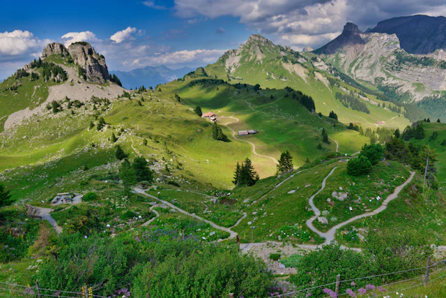
A loop from the top station past the mountain hotel to the Daube viewpoint, then along a ridge with Eiger, Mönch and Jungfrau on one side and both lakes on the other. In July the alpine roses and edelweiss are out along the path.
Loucherhorn Loop
The quieter twin of the Panorama Trail, with much the same views and a fraction of the traffic. Over the Tuba viewpoint, along a ridge towards the Loucherhorn, then back via the Oberberg huts.
Demanding — a full day, and a head for heights
Schynige Platte — Faulhorn — First
The great traverse of the region and a full day out. High above the tree line the whole way, ending at Grindelwald First — from where the gondola brings you down and the train back to Interlaken. Both railways are seasonal, so check the last departures before you start.
Hardergrat to Augstmatthorn
A different undertaking altogether. The ridge runs from Harder Kulm to the Augstmatthorn along narrow, repeatedly exposed sections with both lakes far below. Swiss Hiking Trails rate it T3 and state plainly that it suits only those without a fear of heights. No water, no refreshment, no way to shorten it once you are on the ridge.
Insider Tip
Plan the mountain railway before the hike, not after. Schynige Platte only runs from 13 June to 25 October, and the last descent from Harder Kulm shifts through the season — the time is posted at the valley station each day. More hikes here end badly because of a missed last train than because of the terrain.
Winter hiking around Interlaken
The high routes close, but the low ones do not. The shore paths along both lakes stay walkable all winter — the Iseltwald route among them, though the boats stop for the winter: the journey back from Giessbach goes from around forty minutes to closer to ninety, which is worth knowing before you set off in January. The Lauterbrunnen valley floor is walkable too, with the Trümmelbach falls shut from November. The Harder Kulm ascent is a forest trail that only becomes serious when it ices over. What does close is the Schynige Platte railway and, from late November, the Harder Kulm funicular — after which the summit is on foot only, and the descent too. Grindelwald First runs through the winter and has prepared winter walking trails at the top.
Practical: passes, gear and the T-scale
Passes. Valley trains and both lake boats are covered by the Swiss Travel Pass; the mountain railways only give a reduction. If your route ends at a different railway from the one it started at — the Faulhorn traverse does — check both fares before setting off.
Gear. For T1 and T2 routes: shoes with a proper sole, water, a windproof layer. Above the tree line add sun protection and something warm, because the wind on a ridge at 2,000 metres bears no relation to the temperature in Interlaken. For T3 routes, ankle-high boots and an honest assessment of your head for heights.
The T-scale. Swiss trails are graded T1 to T6. T1 is a wide path anyone can walk, T2 a marked mountain trail where sure-footedness helps, T3 exposed terrain where a slip has consequences. Everything here is T1 to T3, and the grade is on every route above.
Closures. Trail conditions and closures are published by the cantonal hiking associations and the railways; check them the evening before rather than at the trailhead.
Frequently Asked Questions
Which hike near Interlaken has the best view?
For effort against reward, the Schynige Platte Panorama Trail: two hours, a little over 300 metres of climbing, and a ridge with Eiger, Mönch and Jungfrau on one side and both lakes on the other. Harder Kulm gives you the two-lakes view for far less effort but a narrower panorama. The Hardergrat has the most dramatic outlook of all and asks the most in return.
Do I need a car to hike around Interlaken?
No, and every route on this page is chosen on that basis. All five trailheads are reachable from Interlaken Ost by train, bus, funicular or cogwheel railway, and the travel time is listed with each one. Harder Kulm starts at the station itself; Iseltwald takes a quarter of an hour by bus, Lauterbrunnen twenty minutes by train, Schynige Platte about an hour.
How hard is the hike up to Harder Kulm?
Technically easy, physically not. It is graded T2 — a marked mountain trail with no scrambling and no exposure — but it climbs 750 metres in just over four kilometres, an average gradient of around 18 per cent with almost no flat sections. Allow two and a half to three hours going up.
Are the trails suitable for families with children or dogs?
The Lauterbrunnen valley walk is the easiest of all — flat enough for a pushchair, with waterfalls the whole way. The Iseltwald shore path, the Harder Kulm summit loop and the Loucherhorn Loop also work well for both: marked, never exposed, and none of them climbs more than 150 metres. The ascent from Interlaken suits hiking-accustomed children from around eight. The Hardergrat is unsuitable for either — it is narrow and exposed for long stretches, with drops on both sides.
Which trails should you avoid in bad weather?
The Hardergrat, without exception: wet rock and an exposed ridge are a poor combination, and thunderstorms leave you nowhere to go. The Schynige Platte to First traverse is also better postponed — six hours above the tree line with no shelter. The Harder Kulm ascent stays in forest and is manageable in rain.
When does the hiking season start and end?
Low routes around Harder Kulm are walkable from April to October. Anything from Schynige Platte depends on the cogwheel railway, which only runs from 13 June to 25 October. The high traverse to Faulhorn and First needs settled summer conditions — July to September in practice, since snowfields linger on the north side well into the season.
Does the Swiss Travel Pass cover the mountain railways to the trailheads?
Only partly. Trains in the valley are covered, and the boats on both lakes are fully included. The mountain railways — the Harder Kulm funicular, the Schynige Platte cogwheel railway, the Grindelwald First gondola — give a reduction rather than free travel. Check the operators for the current fares before planning a route that ends at a different railway.
What does the T-scale mean?
It is the Swiss Alpine Club grading for hiking terrain. T1 is a wide, well-made path with no head for heights required. T2 is a marked mountain trail, sometimes steep, with sure-footedness expected. T3 means exposed sections where hands may be needed and a fall would have consequences. Everything on this page is T1 to T3, and the grade is stated with each route.
Route figures: Harder Kulm ascent and summit loop from Bergwelten, the Iseltwald shore path from Bergwelten, Hardergrat from Swiss Hiking Trails, the Lauterbrunnen valley walk from Outdooractive, Schynige Platte routes from our own route data. Trailhead altitudes checked against the federal swisstopo terrain model. Travel times from the Swiss public transport timetable, checked 29 July 2026; all other figures retrieved 28–29 July 2026.